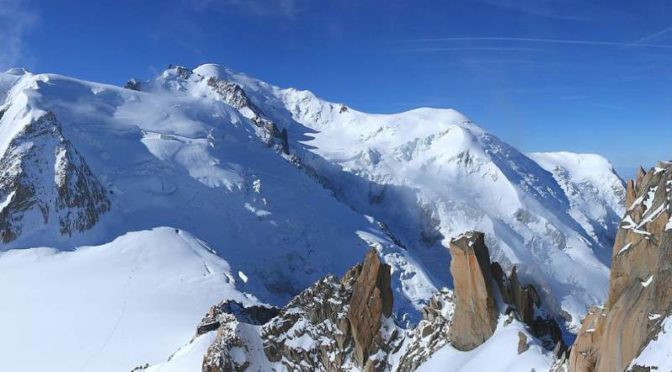
An international team led by the Italian photographer Filippo Blengini created a 365-gigapixel Panorama of Mont Blanc, Europe’s highest mountain, and the gigantic image became the World’s largest photo. The previous record-holder, published in 2013, was a 320-gigapixel shot of London, taken from atop the BT Tower.
The huge image, published on the project’s site In2White, is created by stitching together 70,000 HD photos taken at 3,500 meters (11,483 feet). The shooting took 15 days in late 2014 and the average temperature was -10 °C (14 °F). The post-production took a further two months.

Here’s a behind-the-scenes video published by the In2White team showing how this amazing photo was made:
Creating the world’s largest photo
While creating the world’s largest photo, the team has:
- Took 70,000 photos at 3,500 meters (11,482 feet)
- Created 46 terabytes of data
- Spent 15 days of shooting.
- Post-production took 2 months.
Mont Blanc
Rising 4,808 meters (15,774 feet) above sea level, the Mont Blanc or Monte Bianco, both meaning “White Mountain”, is the highest mountain in the Alps and the highest in Europe west of Russia’s Caucasus peaks. The Mont Blanc massif is popular for mountaineering, hiking, skiing, and snowboarding.
The first recorded ascent of Mont Blanc was on 8 August 1786 by Jacques Balmat (1762-1834, called le Mont Blanc) and the doctor Michel Gabriel Paccard (1757-1827).
Today, around 20,000 mountaineers and tourists ascend the summit each year.
The largest photo ever taken [now the second-largest photo, see the update above]
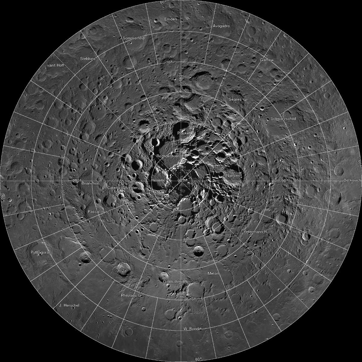
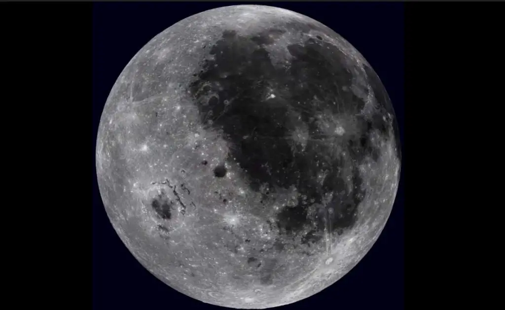
There’s another photo much larger than this, but it wasn’t taken on Earth: NASA published a panorama of the Moon’s surface called “LROC Northern Polar Mosaic (LNPM)” in 2014, and it was 681 gigapixels. The gigantic photo was captured by NASA’s Lunar Reconnaissance Orbiter over four years.
On 18 June 2009, NASA launched the Lunar Reconnaissance Orbiter (LRO) to map the surface of the Moon and collect measurements of potential future landing sites as well as key science targets. After two and a half years in a near-circular polar orbit, LRO entered an elliptical polar orbit on 11 December 2011 with a periapsis (the point where the LRO is closest to the surface) near the south pole and the apoapsis (the point where LRO is furthest from the surface) near the north pole.
The increased altitude over the northern hemisphere enables the two Narrow-Angle Cameras (NACs) and a Wide-Angle Camera (WAC) to capture more terrain in each image acquired in the northern hemisphere. As a result, the Lunar Reconnaissance Orbiter Camera (LROC) archive now contains complete coverage from 60°N to the north pole (except of course for areas of permanent shadow) with a pixel scale of 2 meters.

One of the primary scientific objectives of the Lunar Reconnaissance Orbiter Camera (LROC) is to identify regions of permanent shadow and near-permanent illumination. Since the start of the nominal mission, LROC has acquired thousands of Wide Angle Camera (WAC) images approaching the North Pole. From these images, NASA has produced two very different types of mosaics. The more conventional mosaic is shown above and is composed of 983 images taken over one month during northern summer. This mosaic shows the pole when it is best illuminated, regions that are in shadow are candidates for permanent shadow.
LROC Northern Polar Mosaic (LNPM) by the numbers:
- Square image; 931,070 pixels across and down
- Total pixels: 866,891,344,900 (867 billion)
- Pixels with image data: 680,808,991,627 (681 billion)
- NAC images: 10,581
- Size of compressed mosaic: 950 Gigabytes

Related: Virtual Moon Tour in 4K Ultra HD
Sources
- Mont Blanc on Wikipedia
- Northern Polar Mosaic (LNPM) on lroc.sese.asu.edu
- How Many Elephants are Left in the World in 2025? - August 17, 2025
- Moon Landings: All-Time List [1966-2025] - February 2, 2025
- What Is Max-Q and Why Is It Important During Rocket Launches? - January 16, 2025
