Bombetoka Bay is a bay on the northwestern coast of Madagascar, where the Betsiboka River flows into the Mozambique Channel. It is near the city of Mahajanga, a popular tourist destination, and also an administrative district on the northwest coast of Madagascar. Here are the 5 most amazing photos of Bombetoka Bay from space.
Photos of Bombetoka Bay from space
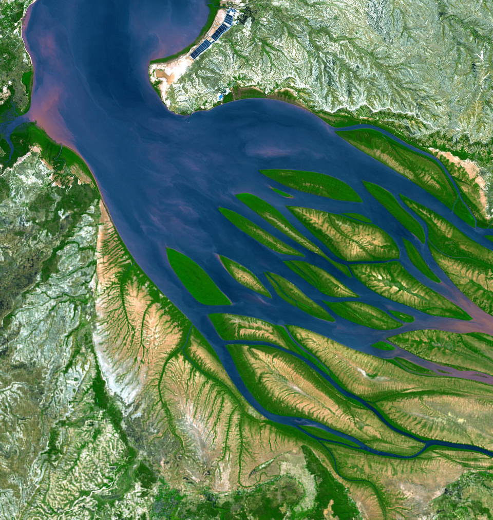
Bombetoka Bay is fed by the Betsiboka River and is a frequent subject of astronaut photography due to its amazing view from space and striking red floodplain sediments.
1. An Otherworldly-Looking Bombetoka Bay from the ISS
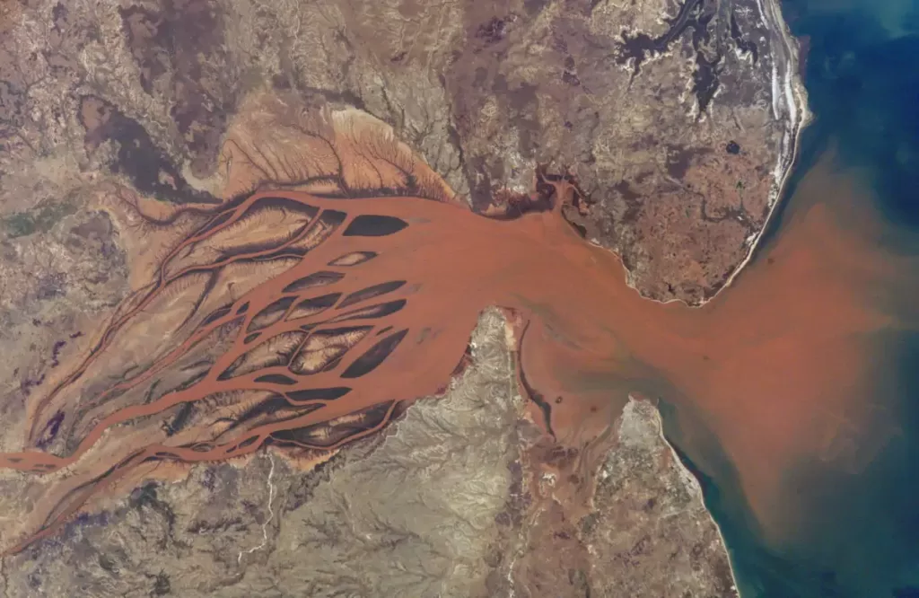
2. A brown-colored Betsiboka River
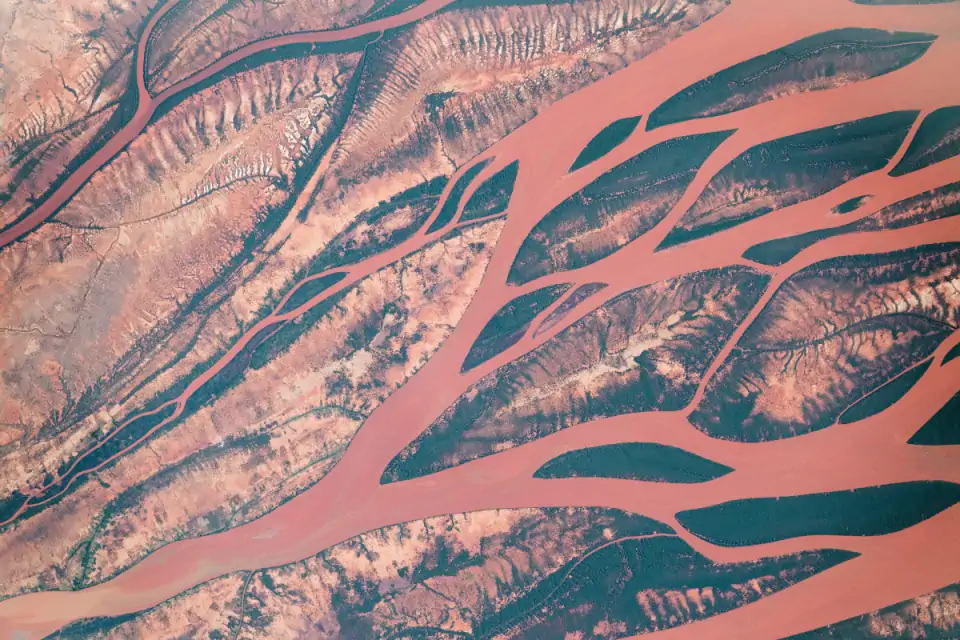
3. A Close-Up View of the Betsiboka river
Nearly a century of extensive logging of Madagascar’s rainforests and coastal mangroves has resulted in nearly complete clearing of the land and very high rates of erosion.
Image: NASA
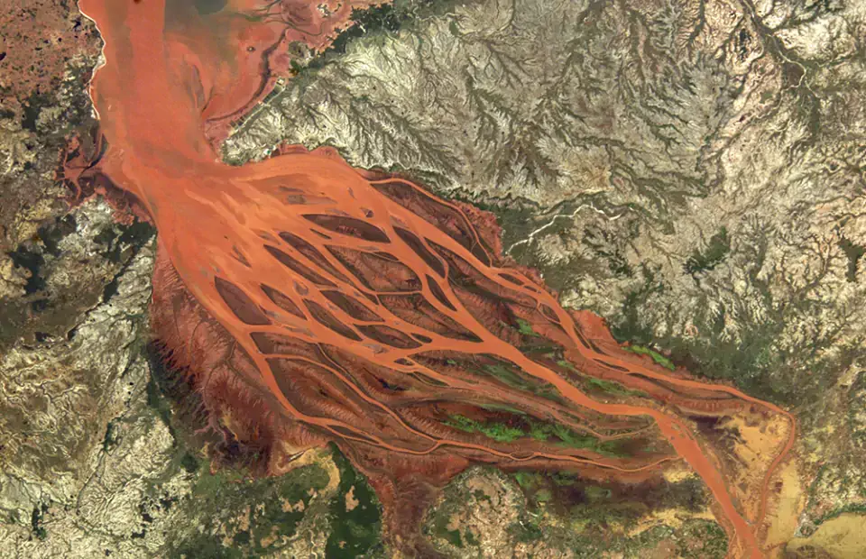
4. Betsiboka Estuary in 2004
5. Estuaries in the Northwest Coast of Madagascar
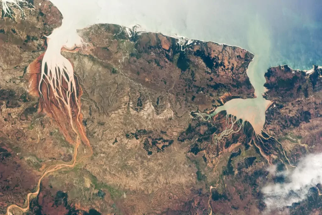
Estuaries are regions where freshwater from rivers and saltwater from the ocean mix, and they are among the most biologically productive ecosystems on Earth. This astronaut photograph (ISS028-E-6687), taken from the International Space Station on June 2, 2011, highlights two estuaries along the northwestern coastline of Madagascar: Betsiboka River and Bombetoka Bay on the left, Mahajamba Bay, Sofia River, and Mahajamba River on the right. The Mozambique Channel on top of this photo separates Madagascar island from the southeastern coast of Africa. Image: NASA
Sources
- Bombetoka Bay on Wikipedia

I am a software developer and a science enthusiast. I was graduated from the Istanbul Technical University (ITU), Computer Engineering. In the past, I worked at the Istanbul Technical University Science Center as a science instructor. I write about the planet Earth and science on this website, ourplnt.com. I am also an animal lover! I take care of stray cats & dogs. This website's all income goes directly to our furry friends. Please consider supporting me on Patreon, so I can help more animals!
Latest posts by M. Özgür Nevres (see all)
- How Many Elephants are Left in the World in 2025? - August 17, 2025
- Moon Landings: All-Time List [1966-2025] - February 2, 2025
- What Is Max-Q and Why Is It Important During Rocket Launches? - January 16, 2025