
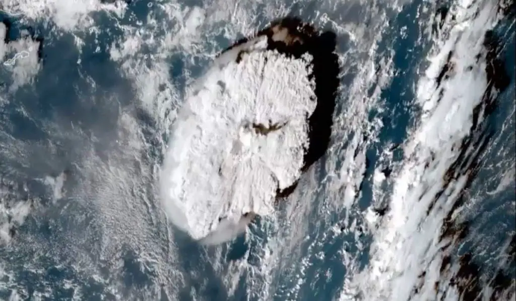
Satellite imagery captures Tonga’s Hunga volcano erupting. The Hunga Tonga-Hunga Ha’apai volcano erupted for the second time in 2 days and the National Oceanic and Atmospheric Administration’s (NOAA) GOES-West satellite captured imagery of the eruption. The eruption also triggered a tsunami that hit the South Pacific Kingdom of Tonga. This time-lapse video composed of images taken from space shows how powerful the eruption was.
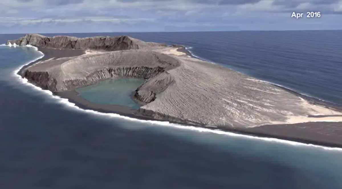
Hunga Tonga-Hunga Haʻapai is a volcanic island located about 30 km (19 mi) south-southeast of Fonuafoʻou island in Tonga. The volcano is part of the highly active Tonga-Kermadec Islands volcanic arc, a subduction zone extending from New Zealand’s north-northeast to Fiji.
A large eruption of the Hunga Tonga volcano occurred on 15 January 2022. A tsunami struck Tonga, a tidal wave was recorded in Fiji, and tsunami warnings were issued in Fiji, Samoa, New Zealand, Australia, and Chile.
As a result of the eruption, a magnitude 4.0 earthquake, and a 1.2-meter (3.9 ft) tsunami, struck the Tongan capital Nuku’alofa.
Notes
- The Geostationary Operational Environmental Satellite (GOES) supports weather forecasting, severe storm tracking, and meteorology research. Built by Lockheed Martin, the GOES-17 supports the GOES system, providing multi-spectral imaging for weather forecasts and meteorological and environmental research.
Sources
- Goes-17 on Wikipedia
- Geostationary Operational Environmental Satellite on Wikipedia
- Hunga Tonga on Wikipedia
- 2022 eruption of Hunga Tonga on Wikipedia

- How Many Elephants are Left in the World in 2025? - August 17, 2025
- Moon Landings: All-Time List [1966-2025] - February 2, 2025
- What Is Max-Q and Why Is It Important During Rocket Launches? - January 16, 2025