In December 2014, an underwater volcano has made a new island with a 120-meter (400-foot) summit in the South Pacific, between two older islands (Hunga Tonga and Hunga Ha’apai) in the kingdom of Tonga. NASA satellites captured the amazing process.
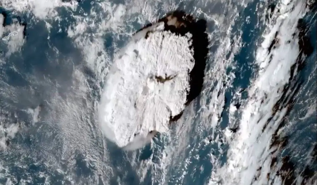
On December 19, 2014, Hunga Tonga-Hunga Ha’apai, a volcano located about 30 kilometers (19 miles) south-southeast of Fonuafo’ou (also known as Falcon Island) in the kingdom of Tonga began erupting. The nearby tourists filmed the huge explosion.
The eruption continued into 2015. On January 11, 2015, a tall ash cloud rose 9 kilometers (30,000 feet) into the sky, causing a number of other flights between New Zealand and Tonga to be canceled. By January 16, when the plume cleared and the ash settled, a new island had been formed by the explosion. The new island is also called Hunga Tonga-Hunga Ha’apai.
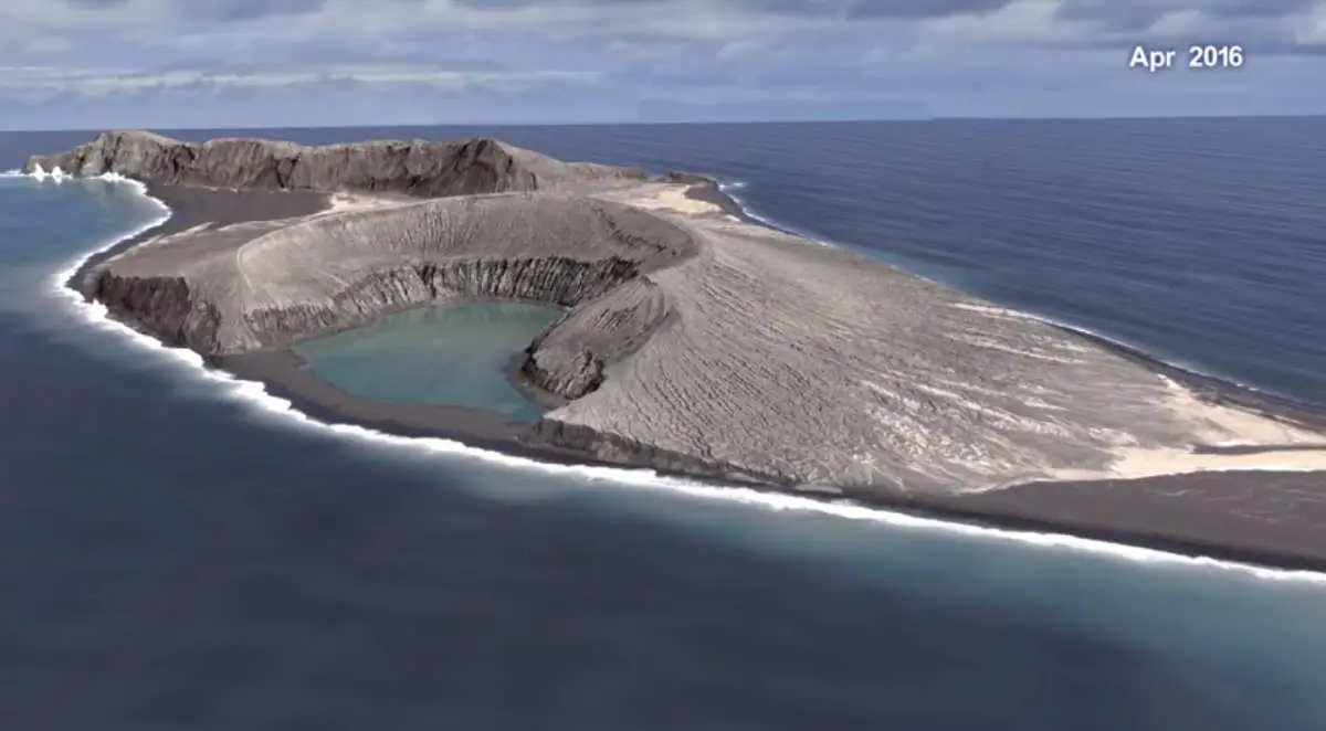
Hunga Tonga-Hunga Ha’apai: the first island created by a volcano eruption in the modern satellite era
Hunga Tonga-Hunga Ha’apai is the first island of this type to erupt and persist in the modern satellite era. It is about 1 kilometer (0.62 mi) wide, 2 kilometers (1.2 mi) long, and 120-meter (400-foot) high. It was expected to wash away after a few months. But, after three years, it’s still there. The time-lapse below, recorded by NASA satellites, show how it’s been holding up over the years.
Scientists still don’t clear how the island has lasted this long. But, according to NASA, it gives scientists an unprecedented view from space of its early life and evolution. The new study offers insight into its longevity and the erosion that shapes new islands.
One theory is that warm seawater interacted with the ash to form a harder rock surface. Understanding these processes could also provide insights into similar features in other parts of the solar system, including Mars. Scientists will run chemical analyses on rock samples to unlock the secrets of this young island of Hunga Tonga-Hunga Ha’apai.
Since the new island emerged above the water line in 2015, it has been tracked regularly through satellite observations by optical sensors and radar (which can penetrate cloud cover in the often-cloudy tropics). NASA scientists were first alerted to the eruption when it was observed by the Moderate Resolution Imaging Spectroradiometer (MODIS) instruments on NASA satellites. A team of researchers then requested regular measurements and high-resolution images by a combination of government and commercial satellites.
Researchers assembled that data into three-dimensional maps of the island’s topography, its changing coastlines and area, and the volume of rock and ash above sea level. The analysis was presented on December 11, 2017, at the fall meeting of the American Geophysical Union.
The images below were acquired in April 2015 and September 2017 by the Operational Land Imager on the Landsat 8 satellite.
The animation below is a composite of images from several satellites, and it shows the evolution of the island. Note how the shape of Hunga Tonga-Hunga Ha’apai flattens and becomes less round over the years. The isthmus, or land bridge, between the new island and Hunga Tonga (to the northeast) also grows wider.
Sources
- “New Island Made of Tuff Stuff” on the NASA Earth Observatory website
- Hunga Tonga on Wikipedia

- How Many Elephants are Left in the World in 2025? - August 17, 2025
- Moon Landings: All-Time List [1966-2025] - February 2, 2025
- What Is Max-Q and Why Is It Important During Rocket Launches? - January 16, 2025