NASA has published a video showing Curiosity Rover‘s (Mars Science Laboratory) proposed route on Mars’ Mount Sharp (Aeolis Mons), a mountain rising 5.5 km (18,000 ft) high from the valley floor. The animated video shows what it would be like to soar over Mount Sharp, officially Aeolis Mons, which the Curiosity has been climbing since 2014.
The video above highlights several regions on the mountain that are intriguing to Curiosity’s scientists, chief among them what the science team calls the “clay-bearing unit,” where Curiosity has just started analyzing rock samples.
The aerial tour also shows Curiosity’s proposed path in the years to come. Intriguing targets include the rocky cliffs of the “sulfate-bearing unit,” where sulfate minerals may indicate the area was drying up or becoming more acidic in ancient times, and Gediz Vallis, where a river may have carved a path through the sulfate unit.
Each region represents a different period in the history of Aeolis Mons. Curiosity’s scientists want to visit these places to learn more about the history of water on the mountain, which slowly dried up as the climate changed.
Understanding how these changes occurred on Mount Sharp may provide new insights into why water – one of the most critical resources for life – disappeared from Mars billions of years ago.
Curiosity Rover’s journey to the Mount Sharp
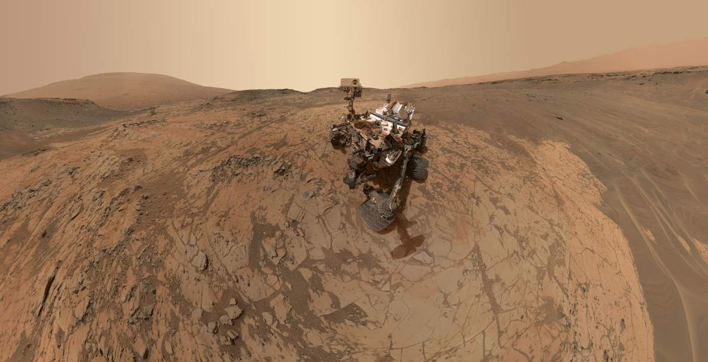
Mount Sharp (Aeolis Mons) is a primary goal for scientific study. Curiosity Rover landed in “Yellowknife” Quad 51 of Aeolis Palus, next to the mountain, on August 6, 2012, with the main goal of determining if Mars was ever able to support microbial life.
- On June 5, 2013, NASA announced that Curiosity would begin an 8 km (5.0 mi) journey from the Glenelg area to the base of Mount Sharp.
- On November 13, 2013, NASA announced that an entryway Curiosity would traverse on its way to Aeolis Mons was to be named “Murray Buttes”, in honor of the American planetary scientist Bruce C. Murray (1931-2013).
- On September 11, 2014, NASA announced that the Curiosity rover had reached Aeolis Mons, the rover mission’s long-term prime destination.
Since then, the robotic rover is climbing Mount Sharp.
Transcript of the Video
Voice: Ashwin Vasavada, Mars Science Laboratory scientist
For almost seven years, NASA’s Curiosity rover has been exploring Mars.
The rover is climbing a mountain: Mount Sharp. That is dry and sandy today. But, three and a half billion years ago, rivers, lakes, and groundwater could be found here.
The white line shows where we’d like to send Curiosity over the next few years.
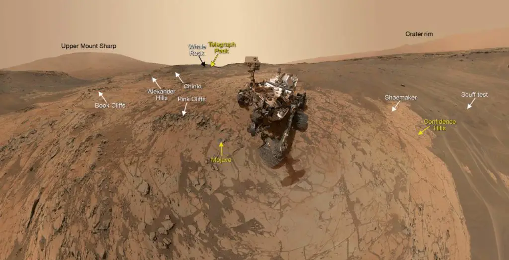
Curiosity recently entered a valley between a ridge and cliffs higher up the mountain. We’ve been calling this area the Clay Unit because Mars orbiters have seen a strong clay signal here.
That’s exciting because clay minerals often form when water is around. From the ground, we can look for clues of ancient water.
In these cliffs, above the Clay Unit, the same orbiters see sulfate minerals. That could mean that water was drying up or becoming more acidic.
Comparing the clay and sulfate layers could give us a better idea of how the Martian climate changed over time.
Cutting through the sulfate layer is evidence of an ancient, gushing river – the Gediz Vallis channel.
In orbiter images, we’ve seen boulders and other debris that were probably washed out by the river.
This channel formed after the clay and sulfate layers. It’s a whole other chapter in the story of water on Mount Sharp. These features can teach us about more than just the mountain.
They may help explain what changes were happening across Mars at the same time. And how that affected its ability to support life if it ever existed here.
Sources
- Mount Sharp on Wikipedia
- Curiosity Rover mission page on the NASA website
- Video: Fly over Mount Sharp on Mars on the NASA website

- How Many Elephants are Left in the World in 2025? - August 17, 2025
- Moon Landings: All-Time List [1966-2025] - February 2, 2025
- What Is Max-Q and Why Is It Important During Rocket Launches? - January 16, 2025