NASA has published some interesting statistics about the world’s sandy beaches on the Earth Observatory website. According to the images taken by Landsat satellites (see notes 1) (Landsat 5 and Landsat 8, see notes 2 and 3), about 31 percent of the world’s coastlines are sandy. Africa has the highest proportion of sandy beaches (66 percent) and Europe has the lowest (22 percent).
A team of researchers from The Netherlands used machine learning to accurately identify sandy beaches in images acquired by Landsat 5 and Landsat 8 satellites. They “taught” their image-classification software to automatically determine whether beaches around the world were sandy, rocky, or icy, and then to examine how the sandy beaches changed between 1984 and 2016.
World’s Sandy Beaches

- According to the data, about 31% of the world’s coastlines are sandy. Africa has the highest proportion of sandy beaches (66%) and Europe has the lowest (22%).
- 24 percent of those sandy beaches, which means a coastline distance of almost 80,000 kilometers (50,000 miles), had eroded at rates exceeding 0.5 meters (1.64 ft) per year.
- 28 percent of sandy beaches had accreted (grew), while 48 percent remained stable.
- Four out of the seven largest erosion hot spots in the world were located in the United States.
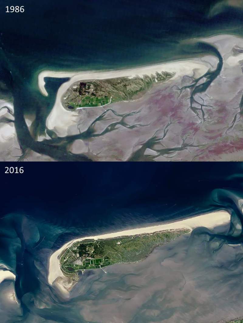
- With a growth of nearly 10 meters (32.8 ft) per year, the beaches at Schiermonnikoog, The Netherlands are among the fastest-growing sandy beaches.
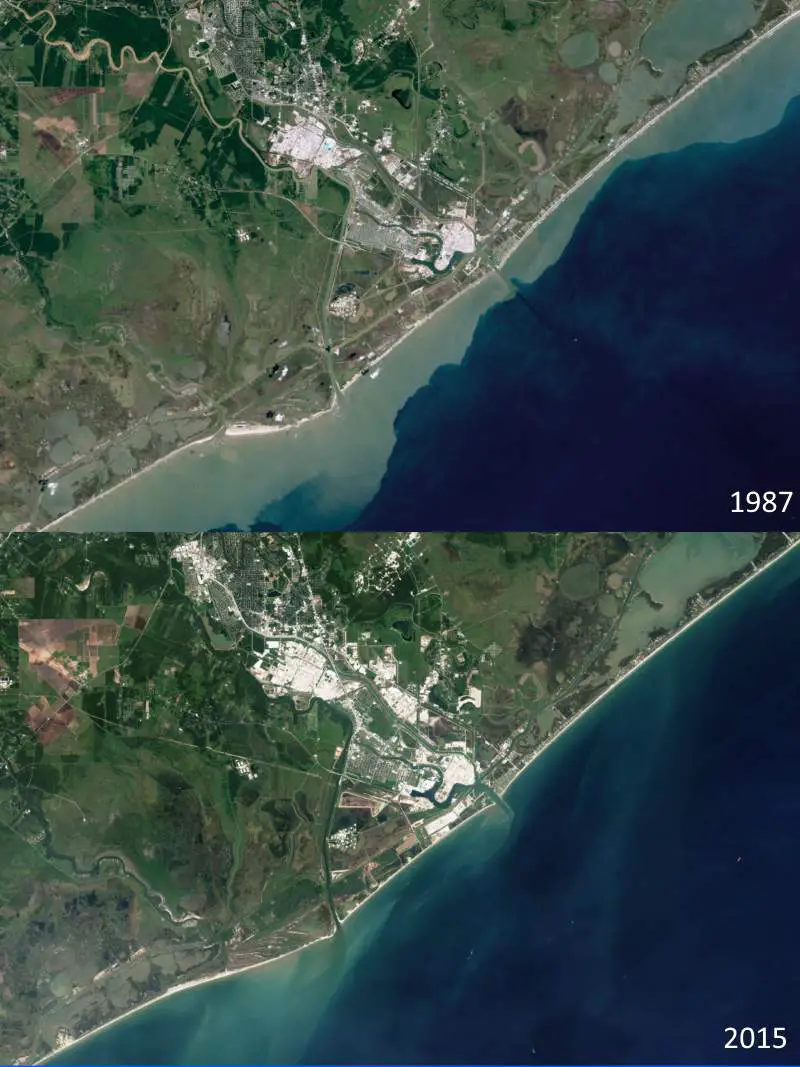
One of the largest erosive hotspots in the world is the area just south of Freeport, Texas. The beach being lost at a rate of nearly 15 meters (50 ft) per year along a 17-kilometer (11-mile) stretch.
Beaches in Australia and Africa have experienced more erosion than growth.
According to researchers, human activities have sped up erosion and accretion for a variety of reasons. For example, Sand mining in Vietnam’s Mekong Delta has caused high rates of erosion that could jeopardize this biologically diverse region and threaten the sustainability of its fishing industry.
On the other hand, the Tweed River Entrance Sand Bypassing Project in New South Wales, Australia, pumps sand from the Tweed River to three beaches in Queensland, enlarging those beaches and improving navigation at the river mouth.
Notes
- The Landsat program is the longest running enterprise for acquisition of satellite imagery of the planet Earth. On July 23, 1972, the Earth Resources Technology Satellite was launched. This satellite was eventually renamed to Landsat. The most recent, Landsat 8, was launched on February 11, 2013. The instruments on the Landsat satellites have acquired millions of images.
- Landsat 5 was a low Earth orbit satellite launched on March 1, 1984, to collect imagery of the surface of Earth. After 29 years in space, Landsat 5 was officially decommissioned on June 5, 2013.
- Landsat 8 is an American Earth observation satellite launched on February 11, 2013. It is the eighth satellite in the Landsat program; the seventh to reach orbit successfully (Landsat 6 failed to reach orbit). Landsat 8 consists of three key mission and science objectives:
- Collect and archive medium resolution (30-meter spatial resolution) multispectral image data affording seasonal coverage of the global landmasses for a period of no less than 5 years;
- Ensure that Landsat 8 data are sufficiently consistent with data from the earlier Landsat missions in terms of acquisition geometry, calibration, coverage characteristics, spectral characteristics, output product quality, and data availability to permit studies of land cover and land-use change over time;
- Distribute Landsat 8 data products to the general public on a nondiscriminatory basis at no cost to the user.
Sources
- “Taking Stock of the World’s Sandy Beaches” on NASA Earth Observatory website
- Landsat program on Wikipedia
- Landsat 5 on Wikipedia
- Landsat 8 on Wikipedia

- How Many Elephants are Left in the World in 2025? - August 17, 2025
- Moon Landings: All-Time List [1966-2025] - February 2, 2025
- What Is Max-Q and Why Is It Important During Rocket Launches? - January 16, 2025