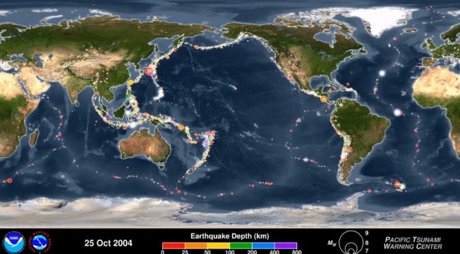
The American scientific agency within the United States Department of Commerce, National Oceanic and Atmospheric Administration (NOAA) published an animation on youtube showing the Earthquakes of the First 15 Years of the 21st Century (between January 1, 2001
In the animation above, the earthquake hypocenters first appear as flashes then remain as colored circles before shrinking with time so as not to obscure subsequent earthquakes. The size of the circle represents the earthquake magnitude while the color represents its depth within the earth. At the end of the animation
Next, it will show only those earthquakes greater than magnitude 6.5, the smallest earthquake size known to make a tsunami. Finally, it will only show those earthquakes with magnitudes of magnitude 8.0 or larger, the “great” earthquakes most likely to pose a tsunami threat when they occur under the ocean or near a coastline and when they are shallow within the earth (less than 100 km or 60 mi. deep).
Here is another (3D) version of the same animation below:
Some of the most powerful earthquakes in history
Read more: Top 10 most powerful earthquakes in recorded history
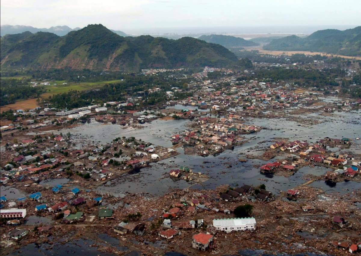
This time period includes some remarkable events – some of the most powerful earthquakes in recorded history. Several large earthquakes caused devastating tsunamis, including 9.1 magnitude in Sumatra, which has a death toll of 230,000-280,000 (December 26, 2004), 8.1 magnitude in Samoa (September 29, 2009), 8.8 magnitude in Chile (February 27, 2010), and 9.1 magnitude off of Japan (March 11, 2011).
Like most

Notable Features of the Earthquakes in this period
- The great majority of earthquakes occur at tectonic plate boundaries.
- The majority of great earthquakes (magnitude 8.0 or larger) are megathrust earthquakes that occur at convergent plate boundaries, also called destructive margins or subduction zones.
- For an earthquake to pose a tsunami hazard it needs to vertically move the seafloor; therefore it needs to be large (typically 8.0 or larger), under or near the ocean, and shallow within the earth (less than 100 km).
- During the 15-year period covered by this animation 20 earthquakes had a magnitude of 8.0 or larger:
- February 6, 2013, MW = 8.0, west of Lata, Solomon Islands
- May 3, 2006, MW = 8.0, Tonga
- August 15, 2007, MW = 8.0, near coast of central Peru
- December 23, 2004, MW = 8.1, north of Macquarie Island (south of New Zealand)
- January 13, 2007, MW = 8.1, east of Kuril Islands, Russia
- April 1, 2007, MW = 8.1, Solomon Islands
- September 29, 2009, MW = 8.1, Samoa Islands
- April 11, 2012, MW = 8.2, off the west coast of northern Sumatra, Indonesia
- April 1, 2014, MW = 8.2, northern Chile
- September 25, 2003, MW = 8.3, Hokkaido, Japan
- November 15, 2006, MW = 8.3, Kuril Islands, Russia
- May 24, 2013, MW = 8.3, Sea of Okhotsk, Russia
- September 16, 2015, MW = 8.3, central Chile
- June 23, 2001, MW = 8.4, near coast of southern Peru
- September 12, 2007, MW = 8.4, southern Sumatra, Indonesia
- March 28, 2005, MW = 8.6, northern Sumatra, Indonesia
- April 11, 2012, MW = 8.6, off the west coast of northern Sumatra, Indonesia
- February 27, 2010, MW = 8.8, offshore of central Chile
- March 11, 2011, MW = 9.1, near the east coast of Honshu, Japan
- December 26, 2004, MW = 9.1, northern Sumatra and Andaman Islands
Emergency Preparedness Checklist
What to do in an earthquake, or during other natural disasters? You can check out this complete emergency preparedness checklist.
National Oceanic and Atmospheric Administration
Formed on October 3, 1970, the National Oceanic and Atmospheric Administration (NOAA) is an American scientific agency within the United States Department of Commerce that focuses on the conditions of the oceans and the atmosphere. NOAA warns of dangerous weather, charts seas, guides the use and protection of ocean and coastal resources and conducts research to provide the understanding and improve stewardship of the environment. In addition to its over 11,000 civilian employees, NOAA research and operations are supported by 321 uniformed service members who make up the NOAA Commissioned Officer Corps.

Related: Humans can cause deadly Earthquakes
Sources
- National Oceanic and Atmospheric Administration on W
ikipedia - Earthquakes – 2001-2015 on sos.noaa.gov
- Moon Landings: All-Time List [1966-2025] - February 2, 2025
- What Is Max-Q and Why Is It Important During Rocket Launches? - January 16, 2025
- Top 10 Tallest Rockets Ever Launched [2025 Update] - January 16, 2025
