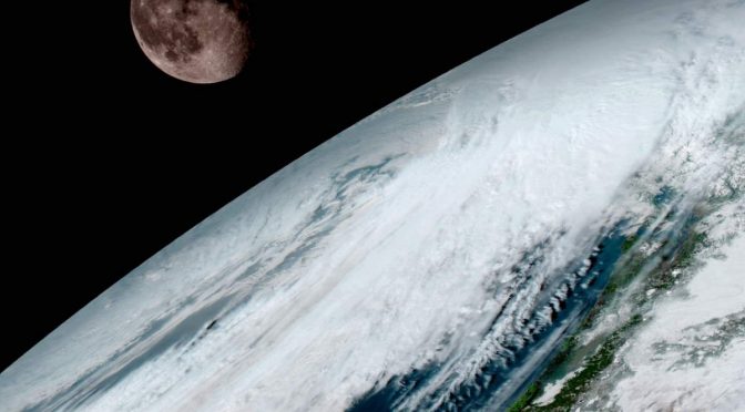
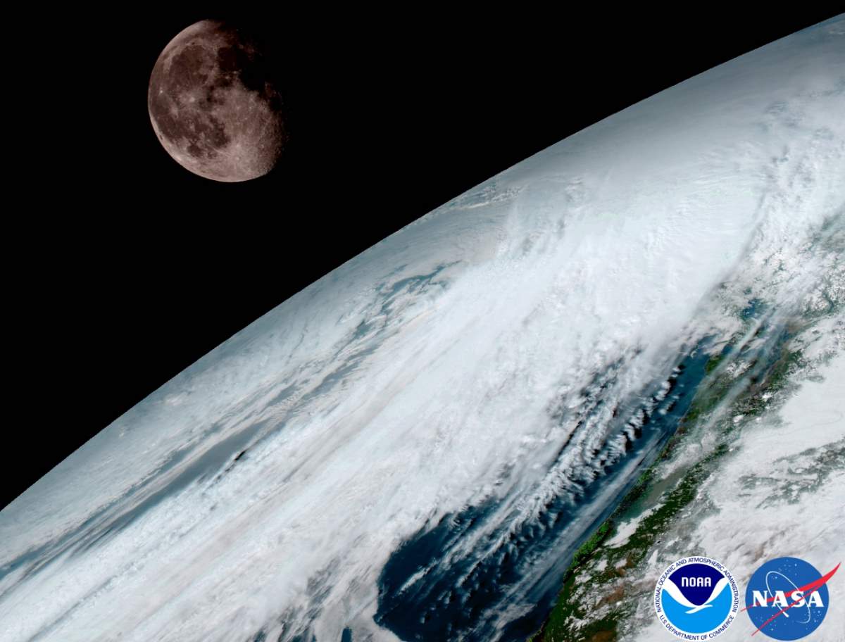
The first set of images from the GOES-16 satellite (see notes 1) have been released by the National Oceanic and Atmospheric Administration (N0AA). In the video below, published by Space.com, you can see the amazing images of the Earth and the Moon.
Notes
- Launched on November 19, 2016, GOES-16, previously known as GOES-R, is the first of the GOES-R series of Geostationary Operational Environmental Satellite (GOES) operated by the U.S. National Oceanic and Atmospheric Administration (NOAA). It provides atmospheric and surface measurements of the Earth’s Western Hemisphere for weather forecasting, severe storm tracking, space weather monitoring, and meteorological research. It is NOAA’s first geostationary weather satellite (see notes 2).
- A geostationary orbit, geostationary Earth orbit, or geosynchronous equatorial orbit (GEO) is a circular orbit 35,786 kilometers (22,236 mi) above the Earth’s equator and following the direction of the Earth’s rotation. An object in such an orbit has an orbital period equal to the Earth’s rotational period (one sidereal day) and thus appears motionless, at a fixed position in the sky, to ground observers.
Illustrating different classes of orbits commonly used by satellites in Earth orbit, there are special classes of orbit designed to solve certain problems and the physics behind them is important.

I am a software developer and a science enthusiast. I was graduated from the Istanbul Technical University (ITU), Computer Engineering. In the past, I worked at the Istanbul Technical University Science Center as a science instructor. I write about the planet Earth and science on this website, ourplnt.com. I am also an animal lover! I take care of stray cats & dogs. This website's all income goes directly to our furry friends. Please consider supporting me on Patreon, so I can help more animals!
Latest posts by M. Özgür Nevres (see all)
- How Many Elephants are Left in the World in 2025? - August 17, 2025
- Moon Landings: All-Time List [1966-2025] - February 2, 2025
- What Is Max-Q and Why Is It Important During Rocket Launches? - January 16, 2025