The Earth is an ever-changing canvas, boasting a plethora of natural wonders that have captivated humans for generations. From expansive coral reefs teeming with life to awe-inspiring volcanoes that seem to touch the sky, these marvels remind us of the beauty and complexity of our planet. However, not all wonders stand the test of time. Climate change, natural disasters, and human activities are threatening the very existence of these treasures. A closer look at 10 recently lost natural wonders reveals a tragic but essential story: the urgency to protect what remains and the consequences of neglect.
As we delve into the list of these 10 recently vanished natural wonders, it’s important to remember that their loss serves as a wake-up call. While some of these wonders disappeared due to natural processes, many fell victim to the direct and indirect consequences of human actions: deforestation, pollution, and climate change to name a few. The aim of this article isn’t just to eulogize these lost wonders but to ignite a sense of responsibility. By understanding what led to their disappearance, we can work toward safeguarding the planet’s remaining natural gems, serving as stewards for future generations.
Top 10 Natural Wonders That Were Lost in Recent Times
The Earth is always changing. “The only thing that is constant is
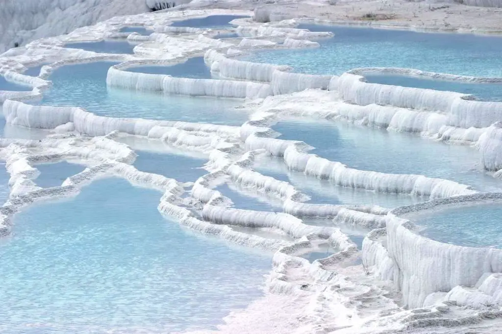
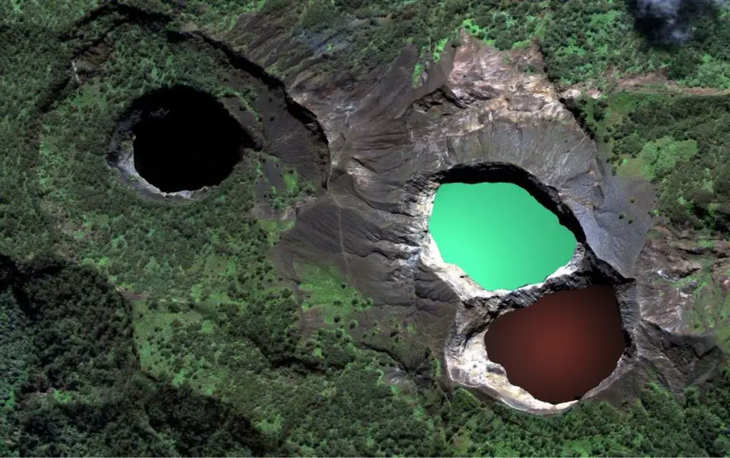
1. Pink and White Terraces [New Zealand]
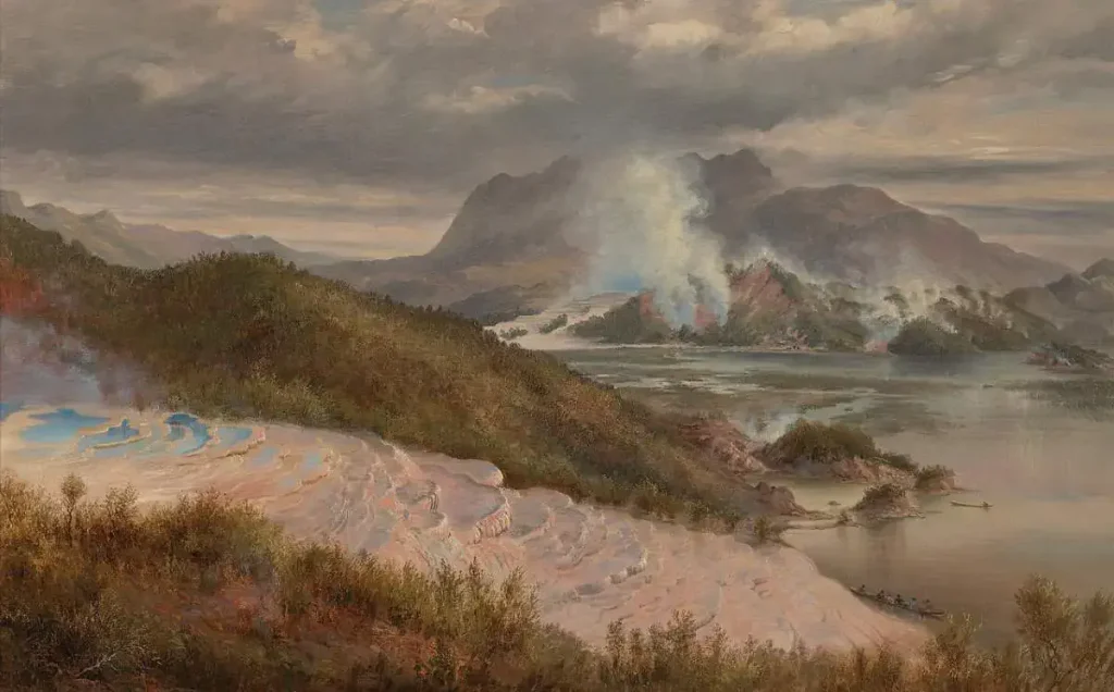
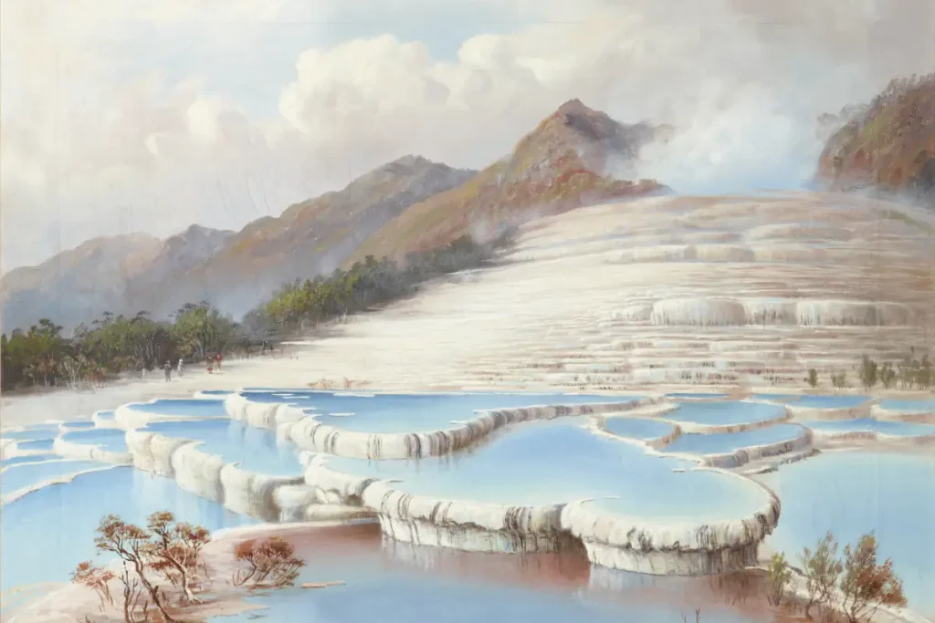
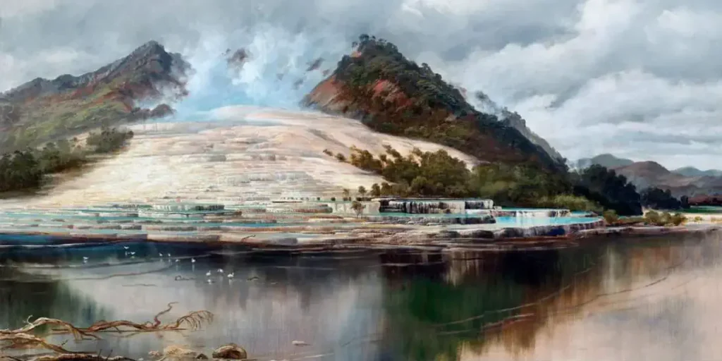
Once the largest silica sinter deposits on earth, The Pink Terrace and the White Terrace were natural wonders of the North Island of New Zealand. Their Māori names were even more beautiful: Te Otukapuarangi (“The fountain of the clouded sky”) for the Pink Terrace and Te Tarata (“The tattooed rock”) for the White Terrace.
The terraces were at the Lake Rotomahana shore, and about 1200 meters (4,000 feet) apart. These terraced formations were made of silica deposits left behind by geothermal springs, and they were famous for their striking colors and intricate, stepped structures.
The White Terraces were known for their expansive, staircase-like formation and their gleaming white appearance, which was caused by the high concentration of silica in the water. The Pink Terraces were smaller but equally impressive, with a delicate pink hue attributed to the presence of traces of minerals like antimony and arsenic.
Visitors from around the world would travel to marvel at these terraces, and they became one of the earliest tourist attractions in New Zealand. People would bathe in the geothermal pools, which were believed to have therapeutic properties. Both terraces were captured in photographs and paintings, serving as stunning examples of natural beauty and geological wonder.
Unfortunately, on June 10, 1886, Mount Tarawera erupted. It was one of New Zealand’s largest historic eruptions and the deadliest eruption in New Zealand since the arrival of Europeans. Up to 150 people, mostly Māori, were killed, and many settlements were destroyed or buried by the eruption. A crater over 100 meters (328 feet) deep encompassed the former site of the terraces.
After some years this crater filled with water to form a new Lake Rotomahana, 30-40 meters (100-130 feet) higher, ten times larger and deeper than the old lake. The Pink and White terraces were lost.
Or at least, they were supposed to.
Fast forward to 2011. In February 2011, while mapping the floor of Lake Rotomahana, a team including researchers from GNS Science (see notes 1), Woods Hole Oceanographic Institution, Lamont-Doherty Earth Observatory, and Waikato University were mapping the lake floor when they discovered part of the Pink Terraces, found the lowest two tiers of the terraces at 60 meters (200 feet) deep.
In June 2011, a part of the White Terraces was also rediscovered by the team.
The expedition was not related to the terraces directly: the team’s goal was to discover how the 1886 eruption had affected the geothermal system that had formed the terraces. The team went back in 2012 and again in February 2014 to photograph the remains, which were published in the Journal of Volcanology and Geothermal Research.
The claims of rediscovery have been challenged by skeptic Bill Keir, who calculated the ‘rediscovered’ structures are not where the terraces were before the eruption. Specifically, the recently discovered structures are 50-60 meters (164-197 feet) under the lake surface, but the historic terraces are expected to be as little as 10 meters (33 feet) under, and “could not be more than 40 meters (131 feet) below the surface”. Keir speculates the structures discovered by the GNS team are prehistoric terraces, never before seen by humans; or perhaps step-shaped objects created by the eruption.
Related: 10 lesser-known natural wonders
2. Guaíra Falls [Brazil and Paraguay]
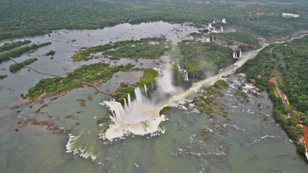
Guairá Falls, once located on the Paraná River between Brazil and Paraguay, was a colossal waterfall system that held the distinction of having the greatest flow rate of any waterfall on Earth. The falls were composed of a series of 18 falls, with a total height of approximately 375 feet (114 meters). Their astonishing flow rate was around 470,000 cubic feet per second (13,300 cubic meters per second), dwarfing even the mighty Niagara Falls. The sound of the falls could reportedly be heard from up to 20 miles away, making it not just a visual spectacle but an auditory phenomenon as well.
However, like many natural wonders that have disappeared due to human activities, Guairá Falls no longer exists. The falls were submerged in 1982 following the completion of the Itaipu Dam, one of the world’s largest hydroelectric projects, and included in the Seven Wonders of the Modern World list.
The dam was constructed to harness the immense power of the Paraná River to produce electricity and was a joint venture between Brazil and Paraguay. While the Itaipu Dam has been a remarkable success in terms of energy production, as it supplies about 15% of Brazil’s electricity and 90% of Paraguay’s, the cost to the environment and the loss of the Guairá Falls were significant.
The submergence of Guairá Falls had multiple ramifications. Apart from the loss of a natural wonder, the damming of the river led to the displacement of local communities and had an impact on the area’s ecology. The rich biodiversity that thrived in and around the falls, including various species of fish that used the falls for spawning, was severely affected.
Furthermore, the falls were of cultural and spiritual significance to indigenous communities, and their loss is felt to this day.
The fate of Guairá Falls serves as a complex example of the trade-offs between development and conservation. On the one hand, the Itaipu Dam has been pivotal for energy generation and economic growth in Brazil and Paraguay. On the other, the loss of the falls is a permanent alteration of the natural landscape, wiping out a unique geological and ecological feature forever.
3. Azure Window [Malta]
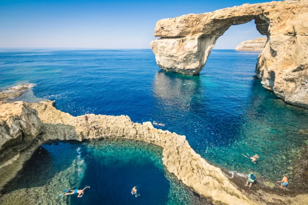
The Azure Window, also known as the Dwejra Window, was a stunning natural limestone arch located on the island of Gozo, part of the Maltese archipelago in the Mediterranean Sea. This iconic structure stood near Dwejra Bay and was one of Malta’s most famous tourist attractions, drawing visitors from around the world who came to marvel at its natural beauty, take photographs, and even dive into the surrounding waters.
The Azure Window was created through thousands of years of natural processes, including wind and wave erosion that slowly carved out the arch from the limestone cliffs. It stood about 28 meters high and had a span of around 25 meters. The arch was featured in various films and TV shows, most notably serving as a backdrop in the first episode of the television series “Game of Thrones,” further elevating its global recognition.
However, the Azure Window was under threat for many years due to natural erosion. Signs of its impending collapse included the falling of large rocks from the arch and visible cracks. Despite efforts to preserve the site, including banning people from walking on the arch, nature had its way, and the Azure Window collapsed on March 8, 2017. The collapse occurred during a storm, and by the time the storm had passed, the arch had completely disappeared into the sea, leaving only the pillars that had supported it.
The loss of the Azure Window was a significant event, both culturally and economically. It led to debates about how to preserve natural wonders and the potential impacts of tourism on vulnerable sites. In the wake of its collapse, there were discussions about constructing an artificial replacement, though such ideas were met with mixed reactions. Some believe that the natural process that led to its formation and eventual collapse should be respected, and any attempt to artificially recreate it could be seen as inauthentic.
Since its collapse, the site has become a popular spot for divers exploring the underwater remains of the arch and the rich marine life around it. Although the Azure Window is gone, its legacy as a symbol of natural beauty and the transient nature of geological formations continues to be remembered and studied.
4. Hetch Hetchy Valley [The United States]
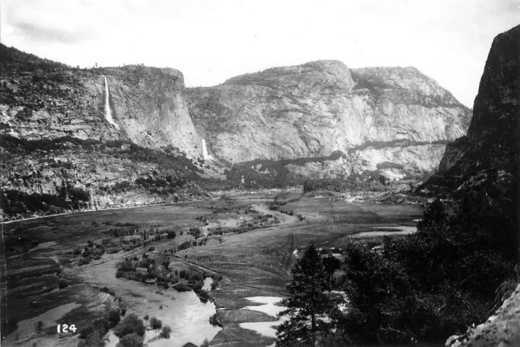
Hetch Hetchy Valley was once a stunning natural valley in the Sierra Nevada mountain range in California, United States. Often compared to the more famous Yosemite Valley for its scenic beauty, Hetch Hetchy was adorned with towering cliffs, waterfalls, and a meandering river. The valley was part of what is now Yosemite National Park and was considered a natural wonder by many who visited it.
However, the fate of Hetch Hetchy took a dramatic turn in the early 20th century. San Francisco, following the devastating earthquake and fire of 1906, was in dire need of a stable water supply and hydroelectric power. Hetch Hetchy was identified as a perfect location for a reservoir, given its granite confines and the availability of freshwater from the Tuolumne River. The proposal to build the O’Shaughnessy Dam and flood Hetch Hetchy Valley became a subject of intense national debate.
The campaign to dam Hetch Hetchy pitted utilitarian needs against natural preservation, leading to a significant rift in public opinion. On one side was the city of San Francisco and supporters who argued that the development was necessary for the public good. On the other side were conservationists, led by figures like John Muir, founder of the Sierra Club, who fought tooth and nail to preserve the valley’s natural state. Despite the strong opposition, Congress passed the Raker Act in 1913, granting San Francisco the right to dam the Hetch Hetchy Valley.

The dam was completed in 1923, and the valley was flooded, submerging the unique ecosystems, scenic waterfalls, and granite cliffs under hundreds of feet of water. The reservoir created by the dam now supplies water to the San Francisco Bay Area and generates hydroelectric power.
The loss of Hetch Hetchy is often considered one of the most significant defeats in the history of the American environmental movement. While the reservoir serves a practical purpose, the flooding of the valley is cited as a cautionary tale of the consequences of prioritizing utility over preservation. Various groups continue to advocate for the restoration of Hetch Hetchy, although such an endeavor would be complex, costly, and politically challenging.
Today, Hetch Hetchy serves as both a vital water source and a somber reminder of the sacrifices made in the name of progress. It remains a point of contention in discussions about conservation, land use, and the ethical implications of altering natural landscapes for human benefit.
5. Darwin’s Arch [Equador]
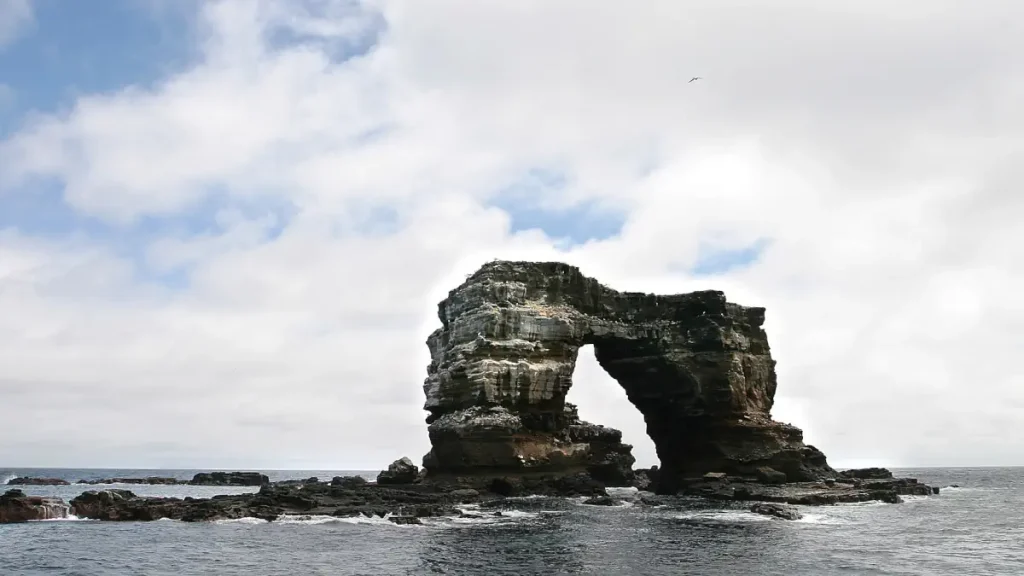
Darwin’s Arch, an iconic natural rock formation in the Galápagos Islands, collapsed on May 17, 2021. This loss was felt deeply not just by Ecuador, which has jurisdiction over the Galápagos, but also by the global scientific and conservation communities. The arch was located less than a kilometer away from Darwin Island, named after Charles Darwin, who formulated the theory of natural selection after studying the unique biodiversity of the Galápagos.
The arch was a popular spot for scuba divers and was also an important subject of various scientific studies due to the rich biodiversity in its vicinity. The waters around Darwin’s Arch are known for their large schools of fish, hammerhead sharks, and other marine life that have been a focus of study for marine biologists and ecologists.
The collapse of the arch was attributed to natural erosion, accelerated by factors such as wind, sea currents, and the natural wear and tear that comes from being battered by waves. Natural erosion is a geological process that shapes landscapes over time, but the sudden collapse of such an iconic structure served as a stark reminder of the impermanence of natural wonders.
While the collapse of Darwin’s Arch was a natural event, it has raised discussions around broader environmental issues like climate change and human impact on natural habitats. Though there’s no direct evidence linking the collapse to human activities, the event brings attention to the broader vulnerabilities that iconic natural structures face in an era of global environmental change.
Though Darwin’s Arch is lost, the pillars that supported the arch still stand and have been informally named “The Pillars of Evolution.” The area continues to be a site of scientific interest and a destination for eco-tourism, but the collapse has led to renewed calls for rigorous scientific monitoring of similar natural structures to better understand the processes that lead to their formation and eventual erosion.
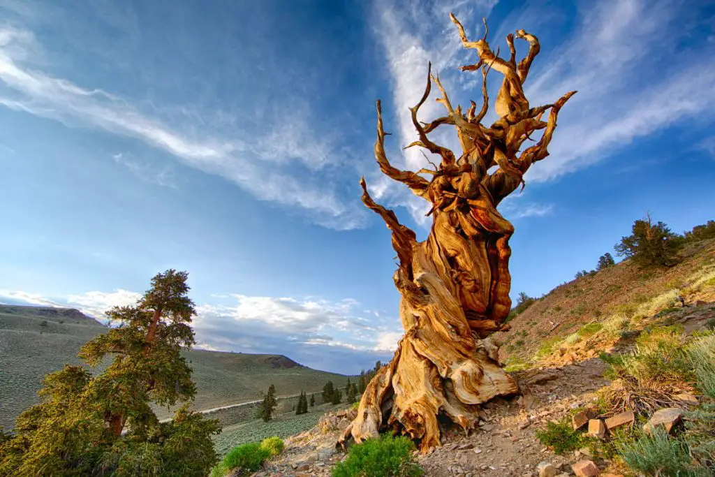
6. Prometheus tree [The United States]
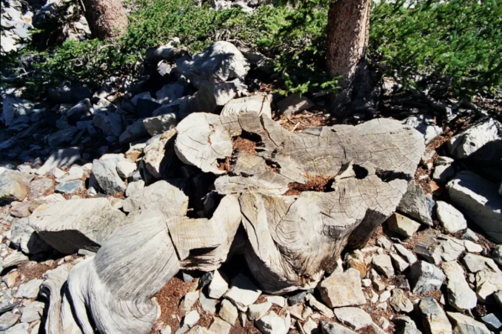
The Prometheus tree was an ancient Great Basin bristlecone pine tree that stood in the White Mountains of eastern California. Named after the mythical Greek Titan who stole fire from the gods and gave it to humanity, the Prometheus tree met a similarly tragic fate. It was cut down in 1964 by a graduate student named Donald R. Currey, who was conducting research on ice age glaciation patterns.
The story begins with Currey taking core samples from bristlecone pines in the area to study their growth rings as part of his research. The bristlecone pines are known for their remarkable longevity, and their growth rings provide valuable climate data stretching back thousands of years. Unfortunately, Currey’s coring tool broke while attempting to take a sample from the Prometheus tree. To continue his research, and after obtaining permission from the United States Forest Service, he decided to cut down the tree.
It was only after the tree was cut and its rings were counted that the full impact of the act became apparent. The Prometheus tree was estimated to be around 4,900 years old, and possibly more than 5000, making it the oldest known non-clonal, single-stemmed living organism at the time. The cutting down of such an ancient and invaluable specimen caused a public outcry and led to ethical debates about scientific research and conservation. The event was a turning point in the field of dendrochronology (the study of tree rings) and forest management, making researchers and the public more aware of the ecological and historical importance of ancient trees.
While nothing can bring back the Prometheus tree, its story serves as a cautionary tale about the impact of human activities on the environment and the irreplaceable loss that can result from carelessness or a lack of awareness. In the years following the incident, regulations around cutting ancient trees have tightened, and there has been an increased focus on the conservation of old-growth forests and the scientific treasures they hold.
Today, pieces of the Prometheus tree are held in various institutions as both scientific specimens and somber reminders of the tree’s historic and ecological value. The site where the tree once stood is now part of the Great Basin National Park, and a grove of ancient bristlecone pines in the area serves as a living monument to the resilience and longevity of these remarkable trees.
Related: Top 7 Oldest Trees in the World
7. Tree of Ténéré [Niger]

The Tree of Ténéré, sometimes referred to as the “most isolated tree on Earth,” was a solitary acacia tree (either Acacia raddiana or Acacia tortilis) that stood alone in the Sahara Desert in northeastern Niger. This tree was a remarkable living monument, serving both as a geographical landmark and a symbol of life’s resilience in one of the most inhospitable climates on Earth. It was the only tree for about 250 miles (400 km) and was once considered the most isolated tree in the world.
Located in the Ténéré region, the tree survived thanks to its extraordinarily deep roots, which reached down to tap into an underground water source. The roots were said to go as deep as about 33 meters (approximately 110 feet), a testament to how life can adapt to even the most extreme conditions. Over time, the tree became a vital navigational landmark for caravans and travelers crossing the vast emptiness of the Sahara.
Sadly, the Tree of Ténéré met an unfortunate end in 1973 when it was knocked down by a drunk Libyan truck driver. The remains of the tree were moved to the National Museum of Niger in Niamey, the country’s capital, where they are preserved. A metal sculpture representing the tree was erected in its original location to serve as a monument to the lost natural wonder and to continue its role as a navigational aid for travelers.
The story of the Tree of Ténéré captivates people for many reasons. It’s not just a story of ecological uniqueness but also one of cultural significance. For the local Tuareg population, the tree was more than just a landmark; it was a symbol of life and endurance, embodying the resilience and isolation of the Saharan people themselves.
8. Kiidk’yaas [Canada]
Kiidk’yaas, commonly known as the Golden Spruce, was a Sitka spruce tree with a rare genetic mutation that caused its needles to be golden in color rather than the typical green. The tree was a natural wonder and held significant cultural importance, particularly for the Haida Nation, an Indigenous people of the Pacific Northwest Coast of North America. The golden needles contained no chlorophyll, the pigment responsible for the green color in most plants and crucial for photosynthesis. Despite this, the tree was able to survive and grow, a fact that fascinated botanists and geneticists alike.
The Golden Spruce was located on the banks of the Yakoun River on Graham Island, which is part of the Haida Gwaii archipelago in British Columbia, Canada. The tree was estimated to be about 300 years old and stood around 50 meters (164 feet) tall. For the Haida people, the tree was a spiritual symbol, and its uniqueness was embedded in their cultural narratives and traditions.
However, in 1997, the tree was illegally felled by Grant Hadwin, a logger, and environmentalist who claimed that he cut down the tree as a form of protest against industrial logging companies and what he perceived to be their unsustainable practices. The act was met with outrage, both from the Haida Nation and the broader public. Many saw the act as a form of ecoterrorism or eco-vandalism that destroyed not just a biological marvel but also a cultural and spiritual symbol.
Hadwin was charged with the crime, but he disappeared under mysterious circumstances while en route to his court hearing, and his whereabouts remain unknown. The incident brought attention to the issues surrounding conservation, Indigenous rights, and environmental activism, but it also resulted in the loss of a unique and irreplaceable natural specimen.
In an attempt to perpetuate the unique genetic lineage of the Golden Spruce, grafts and cuttings were taken from the fallen tree and efforts have been made to propagate it. While these efforts have had some success, the original tree and its significance in its natural setting can never be fully replaced.
9. Mukurob [Namibia]
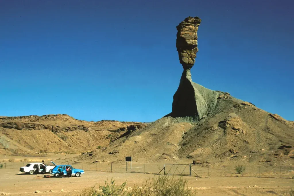
The Mukurob, also known as the “Finger of God,” was a striking rock formation located in Namibia. This natural sandstone pinnacle stood approximately 12 meters (39 feet) high and was one of the country’s most famous landmarks. It was unique because it appeared to defy gravity, with a heavy rock “finger” balanced precariously on a slender pedestal.
The Mukurob was considered sacred by the indigenous San people and was also a popular tourist attraction. However, this iconic structure collapsed on December 7, 1988, under mysterious circumstances. Theories about its collapse range from natural weathering to seismic activity or even shock waves from a distant explosion. Its sudden disappearance was lamented as a significant loss, both culturally and geologically.
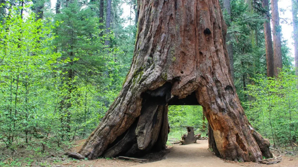
10. California’s last iconic Sequoia “Tunnel Tree” [The United States]
The last giant sequoia with a drive-through archway in its trunk, the 1,000-year-old Pioneer Cabin Tree, also known as the “Tunnel Tree,” was a giant sequoia located in California’s Calaveras Big Trees State Park. This iconic tree was famous for the tunnel carved through its trunk, which allowed visitors to walk and later drive through it.
The tunnel was hollowed out in the 1880s, following the example of Yosemite’s Wawona Tree (see below), in an effort to boost tourism. For decades, the Pioneer Cabin Tree was a beloved attraction, capturing the imaginations of tourists and photographers alike.
Unfortunately, the tree fell during a powerful winter storm on January 8, 2017. Its collapse was a poignant moment that stirred conversations about the vulnerability of these majestic natural landmarks, particularly when altered by human intervention. The loss of the Pioneer Cabin Tree served as a cautionary tale about the delicate balance between tourism and conservation, highlighting the need to protect these ancient giants for future generations.

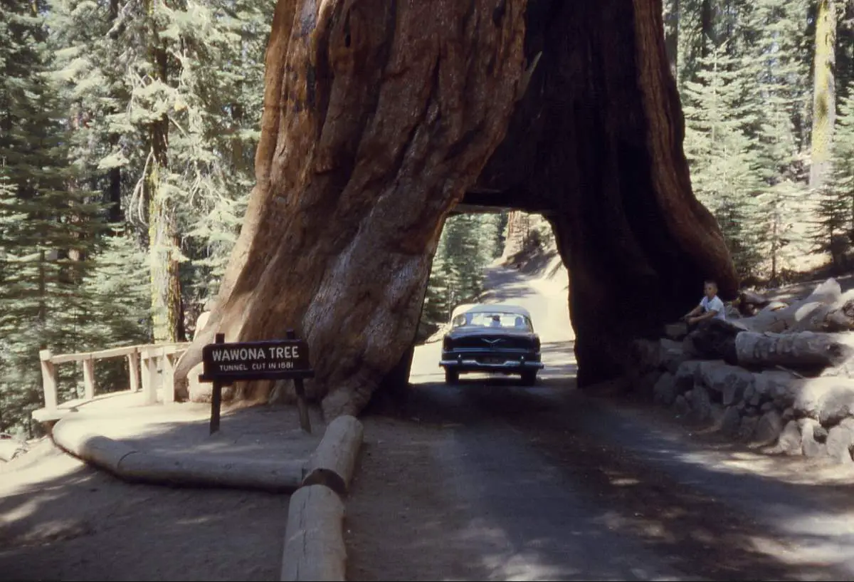
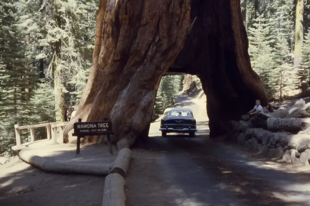
Another fallen tunnel tree: the Wawona Tree
The most famous tunnel tree was the Wawona Tree, a giant sequoia located in California’s Yosemite National Park. It was one of the park’s iconic landmarks and stood approximately 227 feet tall (69 meters) with a 26-foot diameter (7.9 meters). In 1881, a tunnel was carved through its base to allow horse-drawn carriages and, later, automobiles to pass through, making it a popular tourist attraction.
However, the tree met its demise during a snowstorm in 1969, at an estimated age of 2,300 years, when the weight of the snow caused it to collapse. The tunneling had weakened its base, making it susceptible to environmental stress. Its fall was a significant event that sparked discussions about the ethics and long-term consequences of altering natural landmarks for tourism.
Still existing tunnel trees
Three massive Giant California Redwood trees continue to offer the drive-through experience:
- Chandelier Tree: Located in Leggett, California, the Chandelier Tree is part of the privately owned “Drive-Thru Tree Park.” It stands 276 feet tall, and its tunnel was carved in the late 1930s.
- Shrine Drive-Thru Tree: Found in Myers Flat, California, this tree is part of the Shrine of the Redwoods. A naturally occurring fire hollowed out the base, and it was later enlarged to allow cars to pass through.
- Tour-Thru Tree: Located in Klamath, California, this tree offers a similar drive-through experience. Like the others, a tunnel was carved into its base to allow for cars.
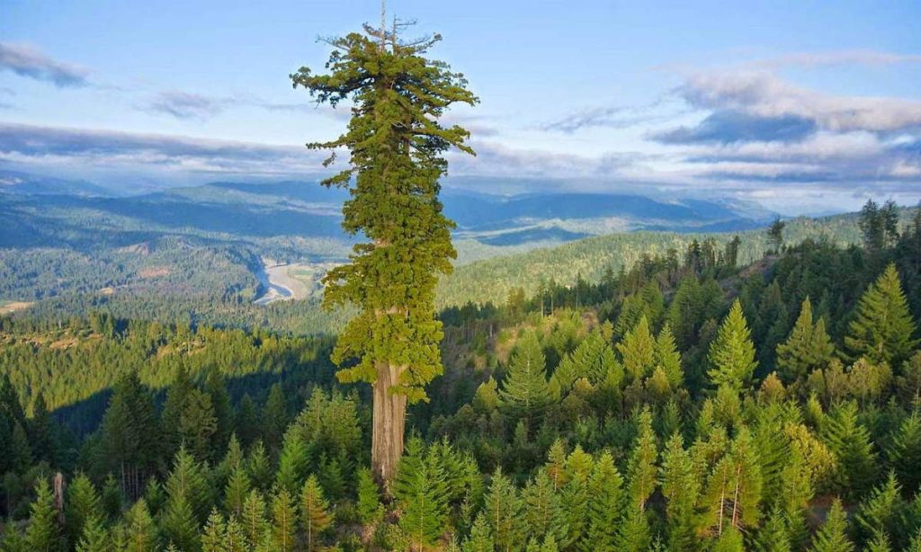
Related – The tallest tree in the world: Hyperion
Notes
- GNS Science (Māori: Te Pū Ao) is a New Zealand Crown Research Institute. It focuses on geology, geophysics (including seismology and volcanology), and nuclear science (particularly ion-beam technologies, isotope science, and carbon dating). It was known as the Institute of Geological and Nuclear Sciences (IGNS) from 1992 to 2005.
Sources
- Pink and White Terraces on Wikipedia
- 1886 eruption of Mount Tarawera on Wikipedia
- GNS Science on Wikipedia
- Guaíra Falls on Wikipedia
- Hetch Hetchy on Wikipedia
- Prometheus (tree) on Wikipedia
- Tree of
Ténéré on Wikipedia - Kiidk’yaas on Wikipedia
- Mukurob on Wikipedia
- “These Breathtaking Natural Wonders No Longer Exist” on the National Geographic website
- Wawona Tree on Wikipedia
- Pioneer Cabin Tree on Wikipedia

- How Many Elephants are Left in the World in 2025? - August 17, 2025
- Moon Landings: All-Time List [1966-2025] - February 2, 2025
- What Is Max-Q and Why Is It Important During Rocket Launches? - January 16, 2025