NASA’s Worldview tool from Earth Observing System Data and Information System (EOSDIS) provides the capability to interactively browse thousands of global, full-resolution satellite imagery layers and then download the underlying data.
Many of the imagery layers that show the entire Earth are updated daily and are available within three hours of observation.
The collection of images are searchable by keyword (e.g. smoke, hurricane, fire, etc.) or mission/instrument (e.g. MODIS, Terra or VIIRS, Suomi NPP) and even by location. This supports real valuable data for time-critical application areas such as wildfire management, air quality measurements, and flood monitoring.
Worldview uses NASA’s Global Imagery Browse Services (GIBS) to rapidly retrieve its imagery for an interactive browsing experience.
The Worldview tool gives you the ability to display a large range of global Earth science satellite imagery with some dating back to February 2000.

Explore NASA Worldview
You can access NASA’s Worldview tool from: worldview.earthdata.nasa.gov
How to use the NASA Worldview tool
Worldview is very similar to other interactive maps you may have encountered before.
You can zoom in and out using the plus (+) and minus (-) buttons on the right side of the map, or you can simply use the mouse wheel. Alternatively, you can also click and hold the mouse button down to pan the map.
You can also search for places using the search textbox on the upper right of the screen. You can enter even coordinates in this search textbox.
Measuring distances/areas is possible using the ruler button on the bottom-right of the screen.
The date can be changed by using the timeline, located in the bottom left. You can either type in a different date, or use the up and down arrows above the year, month, and day fields, or the “back” and “forward” arrows. Alternatively, you can also pick on the timeline to move to another date.
Say you have found something interesting and want to show it to your colleagues or friends: it is very easy to take a snapshot and share by clicking the camera icon on the upper right corner of the screen. Then adjust the corners of the appearing box to select your area of interest. You can select your output resolution and file format.
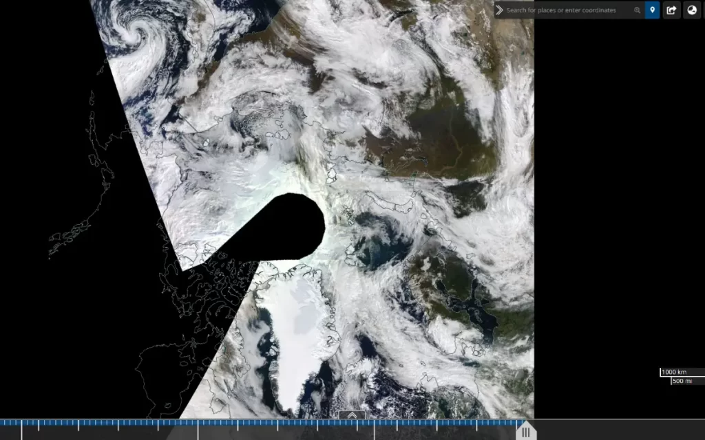
The globe icon on the upper right corner changes the map projection. Here you’ll notice that in addition to the imagery is available in the Geographic projection, some of Worldview’s satellite imagery layers are also available in polar stereographic projections for the Arctic and Antarctic.
If you click on the Arctic projection, you can see a top-down view of the North Pole.
Please note that if it’s wintertime in the Antarctic (summertime in the northern hemisphere), by clicking on the Antarctic projection, you’ll see a black hole in the center of the imagery. This is because, during the Antarctic winter, there isn’t enough sunlight to provide an image.
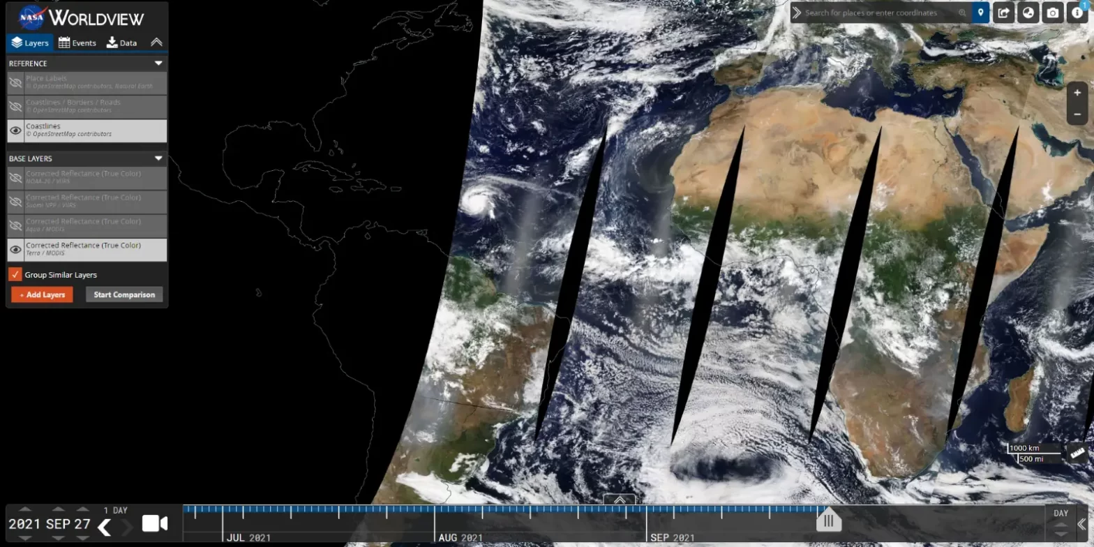
Layers tab
On the “Layers” tab on the upper left of the screen, you can choose what to see. For example, you can show/hide place labels, country borders, coastlines, corrected reflectance, etc.
You can add layers by clicking the “Add layers” button on the bottom of the panel. You can either enter your own keyword in the search bar or browse through the categories.
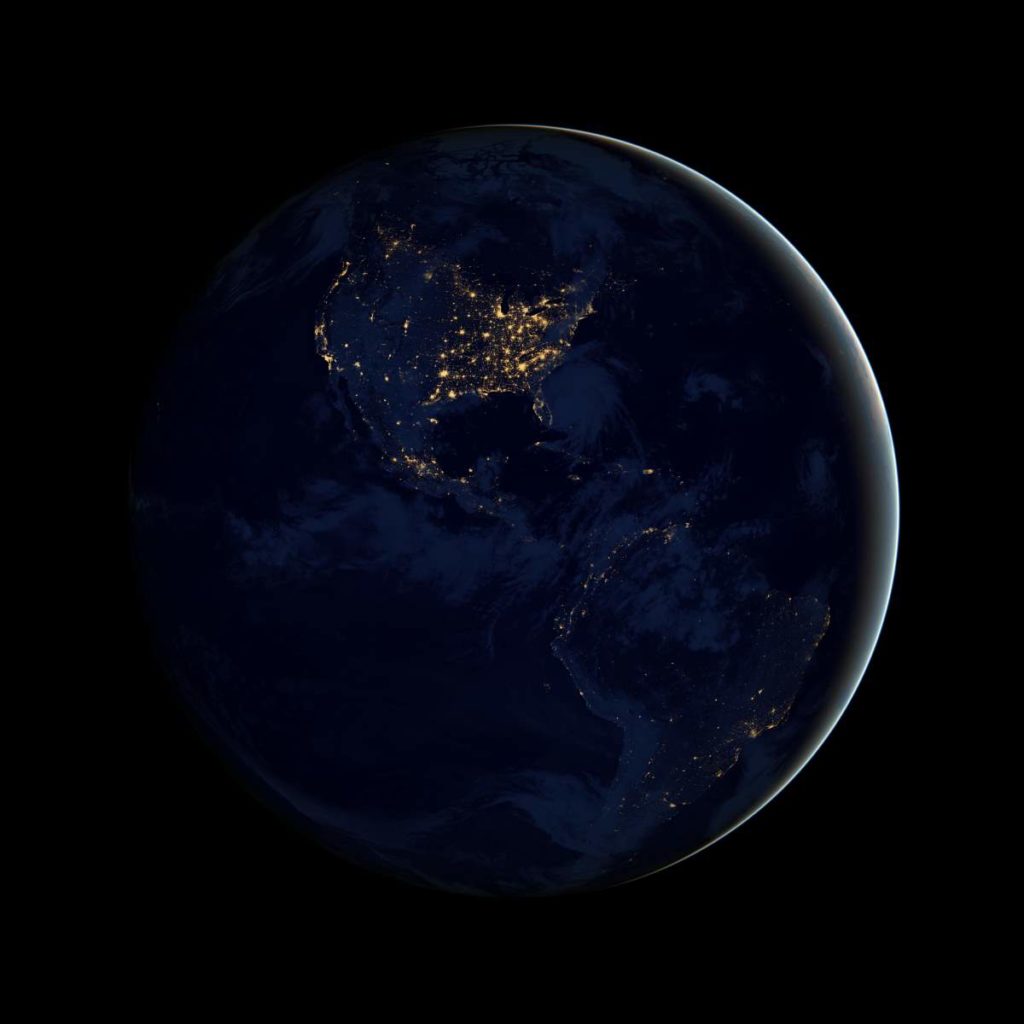
If you for example select “Earth at night” and check the “Nighttime Imagery” checkbox, you can see what the Earth looks like at night.
There’s also a “Start Comparison” button on the layers tab of the Worldview tool. It allows you to compare the same imagery from different dates, different imagery from the same date, or whatever combination that you like.
Events tab
By using the “Events” tab which reveals a list of natural events, you can see current natural hazards and events including wildfires, tropical storms, snow, and volcanic eruptions happening around the world.
Data tab
The underlying data of the Worldview tool is available to download under the “Data” tab.
Video: NASA Worldview tutorial
Sources
- Global Imagery Browse Services (GIBS) on the NASA Earth Data website
- Worldview Image of the Week Archive on the NASA Earth Data website
- Worldview on the NASA Earth Data website

- How Many Elephants are Left in the World in 2025? - August 17, 2025
- Moon Landings: All-Time List [1966-2025] - February 2, 2025
- What Is Max-Q and Why Is It Important During Rocket Launches? - January 16, 2025