
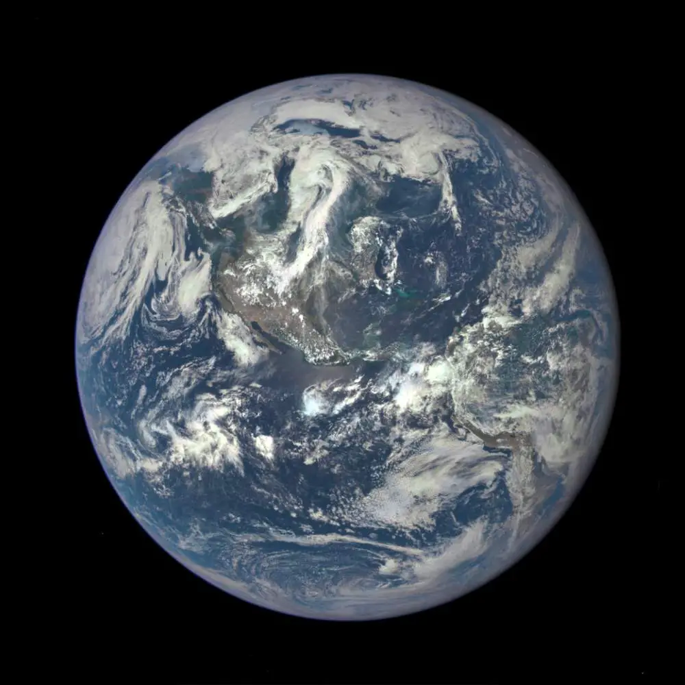
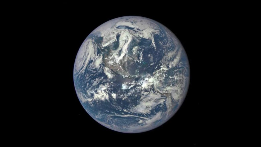
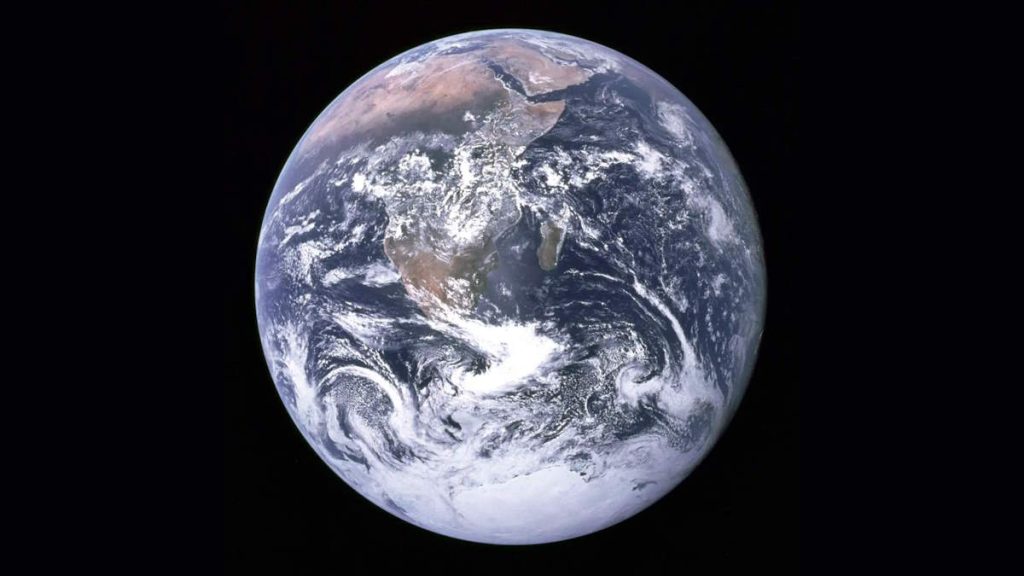
At the Sun-Earth L1 Lagrangian point, 1,500,000 km (930,000 mi) from Earth; NASA’s Deep Space Climate Observatory took an amazing photo of the entire sunlit side of Earth on July 06, 20145. The photo was taken by NASA’s Earth Polychromatic Imaging Camera (EPIC), a four-megapixel CCD camera and telescope. An EPIC Earth image from space!
The final image showing North and Central America was generated by combining three separate images to create a photographic-quality image. The camera takes a series of 10 images using different narrowband filters — from ultraviolet to near-infrared — to produce a variety of science products. The red, green, and blue channel images are used in these color images.
EPIC Earth Image
The Deep Space Climate Observatory (DSCOVR) (formerly known as Triana, unofficially known as GoreSat) was originally developed as a NASA satellite proposed in 1998 by then-Vice President Al Gore for the purpose of Earth observation.
It is at the Sun-Earth L1 Lagrangian point, 1,500,000 km (930,000 mi) from Earth, to monitor variable solar wind conditions, provide early warning of approaching coronal mass ejections, and observe phenomena on Earth including changes in ozone, aerosols, dust, and volcanic ash, cloud height, vegetation cover, and climate.
At this location, it will have a continuous view of the Sun and the sunlit side of the Earth. The satellite is orbiting the Sun-Earth L1 point for a six-month period, with a spacecraft-Earth-Sun angle varying from 4 to 15 degrees. It will take full-Earth pictures about every two hours and be able to process them faster than other Earth observation satellites.
In celestial mechanics, the Lagrangian points are positions in an orbital configuration of two large bodies where a small object affected only by gravity can maintain a stable position relative to the two large bodies.
The Lagrange points mark positions where the combined gravitational pull of the two large masses provides precisely the centripetal force required to orbit with them. There are five such points, labeled L1 to L5, all in the orbital plane of the two large bodies. The first three are on the line connecting the two large bodies and the last two, L4 and L5, form an equilateral triangle with the two large bodies. The two latter points are stable, which implies that objects can orbit around them in a rotating coordinate system tied to the two large bodies.
Several planets have minor planets near their L4 and L5 points (trojans) with respect to the Sun, with Jupiter, in particular, having more than a million of these. Artificial satellites have been placed at L1 and L2 with respect to the Sun and Earth, and Earth and the Moon for various purposes, and the Lagrangian points have been proposed for a variety of future uses in space exploration.
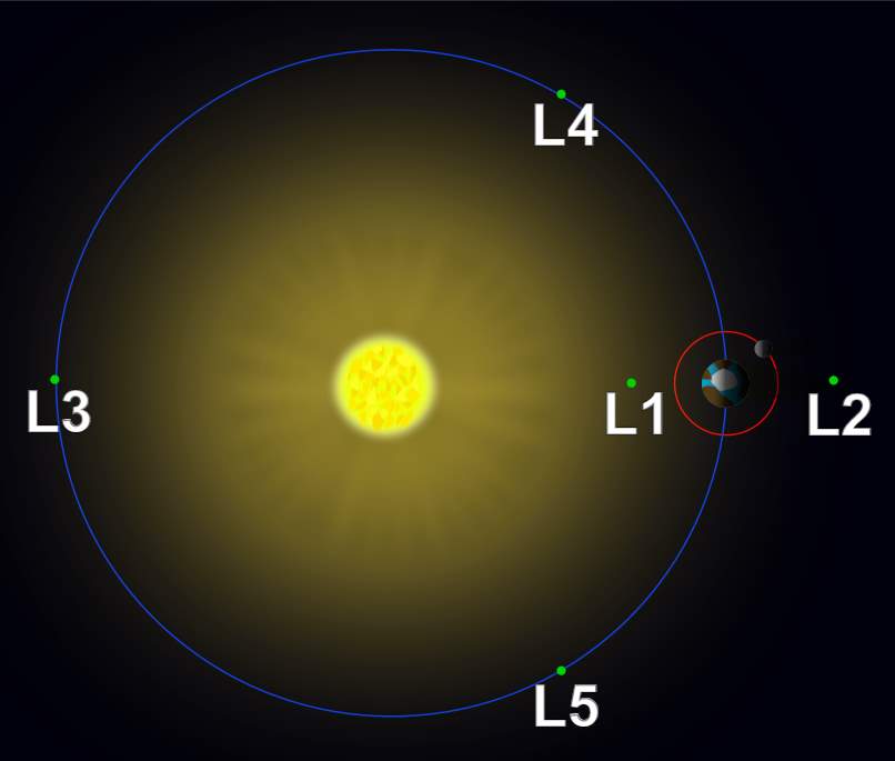
Lagrange Points are special locations in planetary systems where gravitational and rotational forces cancel out. Sometimes we find asteroids or dust clouds lingering near these places. Space missions may use some of these locations for spacecraft as they offer many advantages over orbiting the Earth directly.
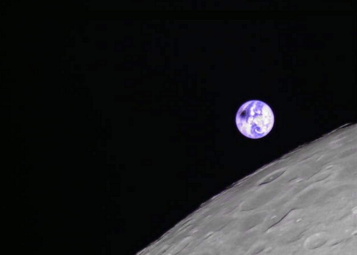
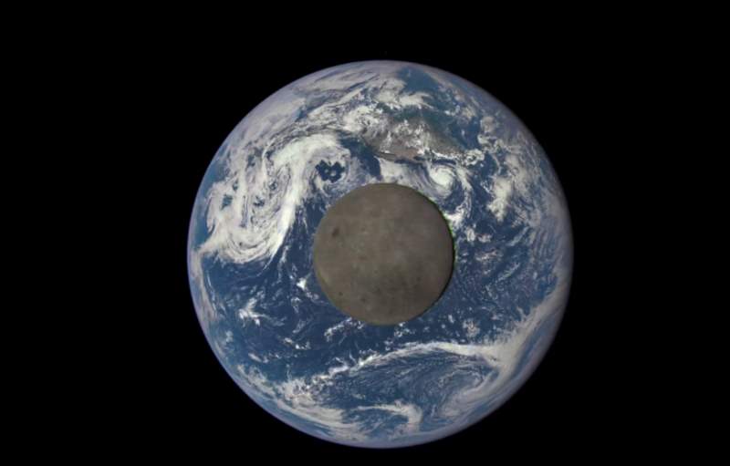
Another “EPIC” view of Earth: Moon Transiting the Earth [Video]
An “EPIC” animation of the Moon transiting the Earth created with actual satellite images of the far side of the moon, illuminated by the Sun. The images are taken by NASA’s Earth Polychromatic Imaging Camera (EPIC), a four-megapixel CCD camera and telescope attached to the Deep Space Climate Observatory (DSCOVR). While the moon was crossing between the DSCOVR and the Earth, EPIC took these beautiful photos almost one million miles (1.6 million kilometers) from Earth.
The distance between the Moon and Earth varies from around 356,400 km to 406,700 km at the extreme perigees (closest) and apogees (farthest).
The Moon is in synchronous rotation: it rotates about its axis in about the same time it takes to orbit Earth. This results in it nearly always keeping the same face turned towards Earth. The Moon used to rotate at a faster rate, but early in its history, its rotation slowed and became tidally locked in this orientation as a result of frictional effects associated with tidal deformations caused by Earth.
The side of the Moon that faces Earth is called the near side, and the opposite side of the far side. The far side is often inaccurately called the “dark side”, but in fact, it is illuminated as often as the near side: once per lunar day, during the new moon phase we observe on Earth when the near side is dark (I am sorry, Pink Floyd, there is no “dark side of the moon”).
Why there wasn’t a solar eclipse in the Moon Transiting the Earth video?
Why wasn’t there a solar eclipse when this was shot, while the Moon transiting the Earth? Because, when these pictures were taken, the Sun was not directly behind the satellite. In fact, NASA purposefully keeps DSCOVR at least 4 degrees away from the Sun-Earth line – the direct path between our planet and the star. It allows researchers to receive satellite data more easily.
DSCOVR conducts its primary mission of real-time solar wind monitoring for the National Oceanic and Atmospheric Administration (NOAA). It was originally developed as a NASA satellite proposed in 1998 by then-Vice President Al Gore for the purpose of Earth observation. It is at the Sun-Earth L1 Lagrangian point, 1,500,000 km (930,000 mi) from Earth, to monitor variable solar wind conditions, provide early warning of approaching coronal mass ejections, and observe phenomena on Earth including changes in ozone, aerosols, dust, and volcanic ash, cloud height, vegetation cover, and climate.
Why does the Moon look so dark in this EPIC video?
A lot of people think the video above (EPIC view of Moon Transiting the Earth) is fake because the Moon looks so dark. Why does the Moon look like that?
Because the moon is dark. Even though it sometimes seems to shine very brightly, the moon reflects only between 3 and 12 percent of the sunlight that hits it. Compared to Earth, which has an average albedo of 30-35% (it widely varies locally across the surface because of different geological and environmental features), our satellite is way less reflective.
The object with the highest albedo in the Solar System is Saturn’s moon Enceladus, which has an albedo of 0.99 (99 percent), which means that it reflects almost all the light it receives from the Sun. Because Enceladus is covered with very reflective snow and ice. The Moon is much more similar to a very dark object, like an asteroid.
Sources
- Deep Space Climate Observatory on Wikipedia
Lagrangian point on Wikipedia - NASA Captures “EPIC” Earth Image on NASA.gov

- How Many Elephants are Left in the World in 2025? - August 17, 2025
- Moon Landings: All-Time List [1966-2025] - February 2, 2025
- What Is Max-Q and Why Is It Important During Rocket Launches? - January 16, 2025