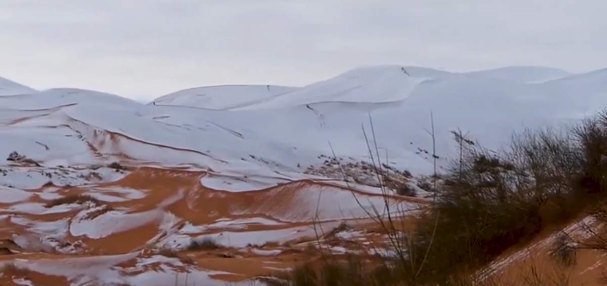
On Sunday, January 07, 2018, the residents of Aïn Séfra, a small town in Algeria, experienced a rare phenomenon: snow in Sahara, the world’s hottest desert. In the video below, published by National Geographic, snow-dusted the desert’s sandy dunes. With temperatures touching 33.8 degrees Fahrenheit (1 °C), this white blanket stayed briefly through the morning before melting away. However, a few residents found the opportunity to enjoy some winter fun.
The town of Aïn Séfra, on the edge of the Sahara desert, was hit by icy weather last week – and even snow. Snowfall is very rare in the Sahara, despite the fact that it can be cold at night – because there’s rarely enough water around for any kind of precipitation.

Related: Top 10 driest places on Earth
Known as “Gateway to the Sahara,” or sometimes “Gateway to the desert”, Aïn Séfra (literally means “yellow spring” in English) is a municipality in Naâma Province, Algeria. Summers are mainly hot and dry. But, despite being in the hot Sahara desert, winters are cool to cold in and around the town. It snowed in 1979 and in the winters of 2016/2017. On 20 January 2017, a freak winter storm hit the area, dumping snow in the municipality up to a meter thick in some places – this was the largest snowfall on record, and also in residents’ memories. It had caused travel disruptions due to roads becoming iced, while children sledged and made snowmen.
So, this year’s snowfall is the third in the last 40 years.
Despite the fact that temperatures can fall below the freezing point at night, snowfall is very rare in the Sahara. Because there’s rarely enough water around for any kind of precipitation, the air is so dry there.
Aïn Séfra was founded in 1881 as a garrison town for the French. With a population of 34,962 inhabitants (as of 1998), it is the second most populated municipality in the province after Mécheria.

Earth From Space: Snow in Sahara
In the video published by the European Space Agency (ESA), the Sentinel-2 (see notes 1) takes us over snow-covered sand dunes in Algeria. Luckily, the Sentinel-2A satellite happened to be in the right place to record this rare event from space at the right time.
“Earth from Space” is presented by Kelsea Brennan-Wessels from the ESA Web-TV virtual studios.

Related: Hottest and Coldest places on Earth
Notes
- Sentinel-2 is an Earth observation mission developed by ESA as part of the Copernicus Programme to perform terrestrial observations in support of services such as forest monitoring, land cover change detection, and natural disaster management. It consists of two identical satellites, Sentinel-2A and Sentinel-2B. The two satellites each carry a high-resolution camera to take images of Earth’s surface in 13 spectral bands. The mission is largely used to track changes in Earth’s land and vegetation, so useful for monitoring desertification.
Sources
- Aïn Séfra on Wikipedia
- Sentinel-2 on Wikipedia
- How Many Elephants are Left in the World in 2025? - August 17, 2025
- Moon Landings: All-Time List [1966-2025] - February 2, 2025
- What Is Max-Q and Why Is It Important During Rocket Launches? - January 16, 2025