Here are the top 32 largest deserts in the world. The list also includes cold deserts.
What is a desert?
A desert is a dry, barren region that receives very little rainfall and has sparse vegetation. Deserts are typically found in areas where there is a high-pressure system that causes the air to descend and warm, causing the air to become dry and hot.
Some of the most well-known desert regions in the world include the Sahara Desert in Africa, the Atacama Desert in South America, and the Mojave Desert in North America. Deserts are characterized by their hot and dry climate, but they also vary in terms of their vegetation, topography, and wildlife. Many deserts are home to unique plant and animal species that have adapted to survive in these harsh conditions.
What is a cold desert?
A cold desert is a desert region with a cold climate, with average temperatures typically below freezing for much of the year. Cold deserts are found in high-latitude or high-altitude regions, where the air is dry and the sun’s rays are less direct, resulting in lower temperatures. These regions tend to have very little rainfall, and the ground is often covered in snow and ice.
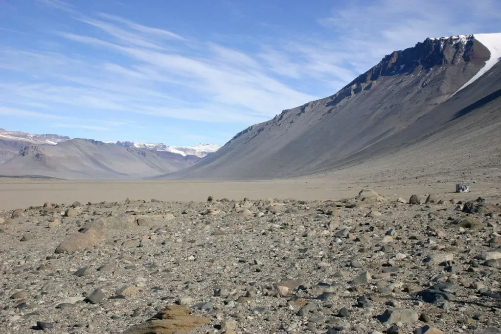
Some examples of cold deserts include the Gobi Desert in Asia and the McMurdo Dry Valleys in Antarctica (in fact, Antarctica itself is considered a desert too). Cold deserts are characterized by their dry and frigid climate, and they are home to various plant and animal species that have adapted to survive in these harsh conditions.
List of Largest deserts in the world
32. Lut desert (Dasht-e Lut) [52,000 km2/20,077 sq mi]
- Type: Subtropical
- Area: 52,000 km2/20,077 sq mi
- Location: Southern Asia
- Country: Iran

The Lut Desert, also known as the Dasht-e Lut, is a large desert region located in eastern Iran. It is known for its extreme temperatures and unique geological features.
The Lut Desert is situated in a rain shadow region, which means that it receives very little rainfall due to the high mountains that surround it. The desert is characterized by its hot and dry climate in the summer. But, the temperatures drop to below freezing in the winter.
The Lut Desert is home to various plant and animal species that have adapted to survive in these harsh conditions. Some of the plants that can be found in the Lut Desert include tamarisk trees, saltbushes, and various species of grasses. The desert is also home to a variety of animal species, including gazelles, lynxes, and sand cats.
The Lut Desert is also known for its unique geological features, such as sand dunes, sandstone cliffs, and salt pans. The Lut Desert is a popular destination for travelers, and it is known for its breathtaking landscapes and unique natural beauty.
What is a Subtropical desert?
A subtropical desert is a desert region that is located in a subtropical climate zone, which is characterized by hot and dry summers and mild winters. These regions are typically found between the Tropic of Cancer and the Tropic of Capricorn, and they tend to have low annual rainfall and high temperatures.
Subtropical deserts are typically found in the interiors of continents, where the air is dry and hot due to the high-pressure systems that prevail in these areas. Some examples of subtropical deserts include the Chihuahuan Desert in North America and the Kalahari Desert in Africa. These deserts are home to various plant and animal species that have adapted to survive in hot and dry conditions.
31. Ladakh desert [59,146 km2/22,836 sq mi]
- Type: Cold winter
- Area: 59,146 km2/22,836 sq mi
- Location: Southern Asia
- Country: India

Ladakh is a region in the northernmost Indian state of Jammu and Kashmir. It is located in the western Himalayas and is known for its rugged, mountainous terrain and high-altitude plateaus. While Ladakh is often referred to as a desert because of its dry, arid climate, it is not a true desert in the traditional sense. Instead, it is a high-altitude cold desert, with cold winters and dry, hot summers.
Ladakh is home to a diverse range of flora and fauna, including many species of high-altitude plants and animals that have adapted to the harsh climate. Some animals found in Ladakh include ibex (any of several species of wild, distinguished by the male’s large recurved horns, which are transversely ridged in front), snow leopards, blue sheep, and marmots.
The region is also home to several major rivers, including the Indus and the Zanskar, which flow through the region and provide a source of water for irrigation and other purposes.
Ladakh is a popular destination for tourists, who come to the region to experience its unique culture and natural beauty. The region is also known for its Buddhist monasteries, which are a major attraction for visitors. Ladakh is also home to a number of outdoor activities, such as trekking, rafting, and mountain biking, which are popular among adventure seekers.
What is a cold winter desert?
Cold winter deserts are also known as semi-arid deserts. They have long, dry summers and extremely cold winters with low rain or snowfall.
30. Ferlo Desert [70,000 km2/27,027 sq mi]
- Type: Subtropical
- Area: 70,000 km2/27,027 sq mi
- Location: Western Africa
- Country: Senegal
Ferlo Desert, also known as the Ferio Desert or the Sahel, is a region located in the north of Senegal in West Africa. It is a semi-arid region that lies between the Sahara Desert to the north and the more humid region of Senegal to the south.
The area is characterized by its dry, hot climate and its sparse vegetation, which consists mainly of scrub brush and grasses. The region is home to a number of small, scattered villages and towns, and it is an important agricultural area, with crops such as millet, sorghum, and peanuts being grown.
In recent years, the Ferlo Desert has faced challenges related to climate change, including prolonged drought and desertification. Despite these challenges, the region is home to a diverse range of cultures and traditions, and it has a rich history dating back to ancient times.
29. Dasht-e Kavir [77,000 km2/29,730 sq mi]
- Type: Subtropical
- Area: 77,000 km2/29,730 sq mi
- Location: Southern Asia
- Country: Iran

Dasht-e Kavir is a large desert in central Iran. It is located in the provinces of Tehran, Isfahan, and Semnan. The desert is known for its harsh, arid climate and rugged terrain, which is characterized by salt flats, sand dunes, and rocky hills.
The Dasht-e Kavir is home to a variety of flora and fauna, including desert plants such as tamarisk and saltwort, and animals such as gazelles, ibex, and wolves. The desert is also home to a number of small settlements, where people have traditionally relied on agriculture, animal husbandry, and trade for their livelihoods.
Despite its harsh conditions, the Dasht-e Kavir has a long history of human habitation, and it has played an important role in the cultural and economic development of Iran. It has also been a major route for trade and communication between different parts of the country, and it continues to be an important transportation corridor today.
28. Chalbi Desert [100,000 km2/38,610 sq mi]
- Type: Subtropical
- Area: 100,000 km2/38,610 sq mi
- Location: Eastern Africa
- Country: Kenya

The Chalbi Desert is a desert located in northern Kenya, near the border with Ethiopia. It is part of the larger Afar Triangle, which also includes the Danakil Desert in Ethiopia and the Red Sea Hills in Eritrea.
It is a harsh and arid environment, with high temperatures, low humidity, and limited rainfall. The desert is home to a number of unique plant and animal species that have adapted to harsh conditions, including the Chalbi bush, which is a small, drought-resistant plant that grows in the desert sands.
The Chalbi Desert is inhabited by a number of indigenous communities, including the Rendille and Samburu peoples, who have lived in the region for centuries. These communities rely on pastoralism and trade for their livelihoods, and they have a deep cultural and spiritual connection to the land.
27. Mojave Desert [124,000 km2/47,877 sq mi]
- Type: Subtropical
- Area: 124,000 km2/47,877 sq mi
- Location: Northern America
- Country: United States

The driest desert in North America, The Mojave Desert is located in the southwestern United States. It covers parts of California, Nevada, Arizona, and Utah. It is also the site of Death Valley, the hottest place on Earth, which is the lowest elevation in North America.
Mojave is home to a variety of plant and animal life, including Joshua trees, cacti, and desert tortoises. It is also home to several military bases and training grounds.
The Mojave Desert is known for its extreme temperatures, with summer temperatures often reaching over 120 °F (49 °C).
Despite the harsh conditions, the Mojave Desert is a popular destination for outdoor enthusiasts, who come to enjoy activities such as hiking, rock climbing, and off-roading.
The desert is also home to a number of unique geological features, including the Mojave National Preserve, which contains the Kelso Dunes, the Cima Dome, and the Marl Mountains.
26. Danakil Desert [137,000 km2/52,896 sq mi]
- Type: Subtropical
- Area: 137,000 km2/52,896 sq mi
- Location: Eastern Africa
- Country: Djibouti, Eritrea, and Ethiopia

The Danakil Desert is a desert region in northeastern Ethiopia, southern Eritrea, and western Djibouti. It is known for its extreme temperatures, with average highs often reaching over 118 °F (48 °C).
Dallol (92 meters / 300 feet below sea level), has the hottest average temperature recorded on earth. Dallol is a volcanic explosion crater (or maar) in the Danakil Depression, northeast of the Erta Ale Range in Ethiopia.
The desert is also home to several active volcanoes, including the Erta Ale volcano, which has a constantly active lava lake.
The Danakil Desert is located in a region known as the Afar Triangle, which is a part of the Great Rift Valley. The area is characterized by its harsh, arid climate and its sparse vegetation, which includes acacia trees and salt-tolerant plants.
Despite its inhospitable conditions, the Danakil Desert is home to a number of indigenous communities, including the Afar people, who have lived in the region for centuries. The Afar people rely on traditional pastoralist practices, raising livestock such as camels, goats, and sheep. They also engage in trade and salt mining, as the region contains large deposits of salt.
Tourism to the Danakil Desert is possible, but it can be challenging due to the harsh conditions and the lack of infrastructure in the region. It is recommended that visitors take necessary precautions and hire experienced guides to ensure a safe and enjoyable trip.
25. Atacama Desert [140,000 km2/54,054 sq mi]
- Type: Mild coastal
- Area: 140,000 km2/54,054 sq mi
- Location: South America
- Country: Chile and Peru
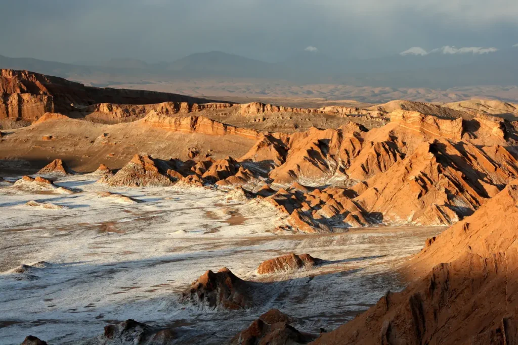
The Atacama Desert is an arid region in northern Chile that stretches along the Pacific coast of South America. It is known for being one of the driest places on Earth, with some areas receiving no rainfall at all for decades.
The Atacama Desert is home to a variety of unique and adapted plant and animal species that have evolved to survive in the extreme conditions of the region.
The desert is also home to a number of indigenous communities, many of which have a long history of living in the region and have developed their own cultures and traditions.
The Atacama Desert is a popular destination for tourists, who come to see its natural beauty and experience the unique culture of the region. Some popular activities in the Atacama Desert include hiking, mountain biking, and visiting the many natural reserves and national parks that are located there.
The desert is also a popular location for scientific research due to its unique climate and geology.
Related: Top 10 driest places on Earth
24. Registan Desert [146,000 km2/56,371 sq mi]
- Type: Subtropical
- Area: 146,000 km2/56,371 sq mi
- Location: Southern Asia
- Country: Afghanistan

The Registan Desert, also known as the Sistan Desert, is an extremely arid plateau region located between Helmand and Kandahar provinces in southeastern Afghanistan. It is a sandy desert consisting of small, red sand hills about 50-100 feet (15-30 meters) high, sand-covered plains, and open rocky and clay-covered areas.
The Registan Desert is migrating westward, encroaching on former agricultural areas in Afghanistan.
23. Dasht-e Margo [150,000 km2/57,915 sq mi]
- Type: Subtropical
- Area: 150,000 km2/57,915 sq mi
- Location: Southern Asia
- Country: Afghanistan
Dasht-e Margo is a desert located in western Afghanistan. It is a large, arid region with sandy dunes and rocky outcrops and is home to a number of indigenous plant and animal species.
The region is also home to a number of small villages and settlements, which are inhabited by nomadic Afghan tribes.
22. Namib desert [160,000 km2/61,776 sq mi]
- Type: Cool coastal
- Area: 160,000 km2/61,776 sq mi
- Location: Middle-Southern Africa
- Countries: Angola, Namibia, and South Africa

The Namib Desert stretches for more than 2,000 kilometers (1,200 miles) along the Atlantic coasts of Angola, Namibia, and South Africa, extending southward from the Carunjamba River in Angola, through Namibia, and to the Olifants River in Western Cape, South Africa.
It is one of the oldest and most arid deserts in the world. The desert is home to a diverse array of flora and fauna, including a number of species that are found nowhere else in the world.
The Namib Desert is known for its dunes, which are some of the highest in the world and can reach heights of over 1,000 feet (300+ meters).
Despite its harsh, dry conditions, Namib is an important habitat for many animals, including antelopes (such as gemsboks and springboks), ostriches, and even desert elephants in some areas.
The Namib is almost completely uninhabited by humans except for several small settlements and indigenous pastoral groups.
21. Ustyurt Plateau [200,000 km2/77,220 sq mi]
- Type: Subtropical
- Area: 200,000 km2/77,220 sq mi
- Location: Central Asia
- Countries: Kazakhstan, Turkmenistan, and Uzbekistan

The Ustyurt or Ust-Yurt (from Kazakh: Үстірт; Uzbek: Ustyurt; Turkmen: Üstyurt; Karakalpak: Ústirt) is a transboundary clay desert shared by Turkmenistan, Uzbekistan, and Kazakhstan. “Üstyurt” means “homeland in the high ground” in Turkish.
It is located between the Dead Kultuk, Mangyshlak Peninsula, and Kara-Bogaz-Gol of the Caspian Sea to the west, and the Aral Sea, Amudarya Delta, and Sarygamysh Lake to the east.
Usyurt is characterized by a dry, harsh climate, with hot summers and cold winters. The landscape is mostly barren, with rocky terrain and sparse vegetation. There are salt marshes, sand dunes, and other features typical of desert environments.
The plateau’s semi-nomadic population raises sheep, goats, and camels.
20. Thar Desert [200,000 km2/77,220 sq mi]
- Type: Subtropical
- Area: 200,000 km2/77,220 sq mi
- Location: Southern Asia
- Countries: India and Pakistan

The Thar Desert, also known as the Great Indian Desert, is an arid region in the northwestern part of the Indian subcontinent.
It is one of the most inhospitable places in the world, with extremely hot temperatures and little rainfall.
Despite its harsh conditions, the Thar Desert is home to a variety of plant and animal life, including the Indian gazelle, the Indian desert cat, and the Indian onager.
It is also home to several indigenous communities.
19. Puntland [200,000 km2/77,220 sq mi]
- Type: Subtropical
- Area: 200,000 km2/77,220 sq mi
- Location: Eastern Africa
- Countries: Somalia
Puntland is a semi-autonomous region in northeastern Somalia. Is bordered by Somaliland to its west, the Gulf of Aden in the north, the Guardafui Channel in the northeast, the Indian Ocean in the southeast, the central Galmudug region in the south, and Ethiopia in the southwest.
Puntland is known for its rugged coastline and arid landscapes. The region is predominantly desert and has a hot, dry climate. However, there are also some areas of savanna and grassland in Puntland, particularly in the south and along the coast.
18. Ogaden Desert [256,000 km2/98,842 sq mi]
- Type: Subtropical
- Area: 256,000 km2/98,842 sq mi
- Location: Eastern Africa
- Countries: Ethiopia, Somalia, and Somaliland
Ogaden is a large, arid region that is characterized by hot, dry weather and scarce water resources. The term Ogaden is attributed to the Somali clan of the same name and the inhabitants of the region are predominantly ethnic Somalis.
17. Taklamakan Desert [270,000 km2/104,248 sq mi]
- Type: Cold winter
- Area: 270,000 km2/104,248 sq mi
- Location: Eastern Asia
- Countries: China

The Taklamakan Desert is a large desert located in the Xinjiang Uyghur Autonomous Region of northwest China.
It is the world’s second-largest shifting-sand desert, after the Sahara Desert in Africa.
Since Taklamakan is thousands of kilometers from any open body of water, it is known for its extreme temperatures, with hot summers and cold winters. In winter, the temperatures can drop below -20 °C (-4 °F), while in summer they can rise up to 40 °C (104 °F).
It is also known for its strong winds, which can whip up sandstorms that can last for days.
The desert is inhabited by a small number of people, mostly ethnic Uyghurs who practice animal husbandry in the region.
16. Kyzylkum Desert [298,000 km2/115,000 sq mi]
- Type: Cold winter
- Area: 298,000 km2/115,000 sq mi
- Location: Central Asia
- Countries: Kazakhstan, Turkmenistan, and Uzbekistan

Kyzylkum (Kızılkum) means “red sand” in Turkic languages. It is located in the land between the confluent rivers Amu Darya and Syr Darya, a region historically known as Transoxania in Central Asia. It is located mostly in Uzbekistan and partly in Kazakhstan and Turkmenistan.
Most of Kyzylkum desert is covered with dunes, but in the northwest large areas are covered with takirs (clay coatings). There are also some oases in the area. There are agricultural settlements along the rivers and in the oases.
It has a harsh climate. Temperatures can be very high during the summer months. Kerki, one extreme inland city located on the banks of the Amu Darya River, recorded 52 °C (126 °F) in July 1983.
In the winter, the temperatures can drop below freezing, as low as -9 °C (15.8 °F).
15. Sonoran Desert [310,000 km2/119,692 sq mi]
- Type: Subtropical
- Area: 310,000 km2/119,692 sq mi
- Location: Northern and Central America
- Countries: Mexico and the United States

The Sonoran Desert (Spanish: Desierto de Sonora) covers the northwestern Mexican states of Sonora, Baja California, and Baja California Sur, as well as part of the southwestern United States (in Arizona and California).
It is the hottest desert in Northern America. According to satellite data from the last two decades, the land in the Sonoran Desert sometimes heats up to a whopping 80.8 °C (177.4 °F). The data also shows that summer temperatures routinely soared above 60 °C (140 °F).
Despite its harsh climate, the Sonoran Desert’s bi-seasonal rainfall pattern results in more plant species than any other desert in the world. It is also home to a wide variety of animals, many bird species, and the Gila monster, bobcat, mule deer, antelope jackrabbit, burrowing owl, greater roadrunner, western diamondback rattlesnake, and elf owl.
Phoenix, Arizona is the largest city in the Sonoran Desert. It has a 2017 metropolitan population of about 4.7 million.
14. Colorado Plateau [337,000 km2/130,116 sq mi]
- Type: Cold winter
- Area: 337,000 km2/130,116 sq mi
- Location: Northern America
- Country: United States

The Colorado Plateau is known for its unique geology, including the Grand Canyon, Bryce Canyon, and Zion National Park. The region is generally considered to be semi-arid, rather than a desert.
But, because of climate change, the area is getting arider and can be as dry as Arizona in the future, scientists say.
13. Great Victoria [348,750 km2/134,653 sq mi]
- Type: Subtropical
- Area: 348,750 km2/134,653 sq mi
- Location: Western and South Australia
- Country: Australia
Great Victoria is the largest desert in Australia. It is actually a part of the Great Australian desert.
It is known for its hot and arid climate, with temperatures often reaching over 40 °C (104 °F) during the summer months. in winter, temperatures fall to 18 to 23 °C (64 to 73 °F).
The desert is home to a variety of plant and animal life. The area is a World Wildlife Fund ecoregion and an Interim Biogeographic Regionalisation for Australia.
The Great Victoria is also home to several Indigenous communities, who have lived in the area for thousands of years.
12. Karakum Desert [350,000 km2/135,136 sq mi]
- Type: Cold winter
- Area: 350,000 km2/135,136 sq mi
- Location: Central Asia
- Country: Turkmenistan

Karakum is a large desert in Central Asia. Its name literally means “black sand” in Turkic languages (kara = black and kum = sand).
Wildlife in this area is not very diverse. Insects such as ants, termites, ticks, spiders, dung beetles, and darkling beetles. Lizards, turtles, and snakes also live in the Karakum. Bird species include Alauda, desert sparrows, and other species, while rodents include jerboas and gophers. The tolai hare, goitered gazelle, and corsac fox are examples of mammal species.
Karakum is home to the Darvaza Crater, also known as the “Door to Hell“. It is a natural gas field in Derweze, Turkmenistan, that collapsed into an underground cavern in 1971, becoming a natural gas crater. Geologists set it on fire to prevent the spread of methane gas, and it has been burning continuously since then.
The diameter of the crater is 69 meters (226 feet), and its depth is 30 meters (98 feet). Today, the crater is a popular tourist attraction.
Karakum is also rich in natural resources, including oil and natural gas.
11. Chihuahuan Desert [453,248 km2/175,000 sq mi]
- Type: Subtropical
- Area: 453,248 km2/175,000 sq mi
- Location: Northern America
- Country: Mexico and the United States

The Chihuahuan Desert is the largest desert in North America. It occupies much of far West Texas, the middle to lower Rio Grande Valley and the lower Pecos Valley in New Mexico, and a portion of southeastern Arizona, as well as the central and northern portions of the Mexican Plateau.
The Chihuahuan has rich wildlife and 7% of its area is protected (about 35,905 km2 or 13,863 sq mi). Protected areas include:
- Buenos Aires National Wildlife Refuge in Arizona
- Janos Biosphere Reserve, Médanos de Samalayuca Natural Protected Area and Cañón de Santa Elena Flora and Fauna Protection Area in Chihuahua
- Cuatro Ciénegas Basin, Ocampo Flora and Fauna Protection Area, and part of Maderas del Carmen Biosphere Reserve in Coahuila
- Mapimí Biosphere Reserve and Cañón de Fernández State Park in Durango
- Bitter Lake National Wildlife Refuge, Bosque del Apache National Wildlife Refuge, Carlsbad Caverns National Park, Carrizozo Malpais, Oliver Lee Memorial State Park, Organ Mountains-Desert Peaks National Monument, Petroglyph National Monument, Sevilleta National Wildlife Refuge, and White Sands National Park in New Mexico
- Big Bend National Park, Big Bend Ranch State Park, Black Gap Wildlife Management Area, Franklin Mountains State Park, and part of Guadalupe Mountains National Park in Texas
10. Great Basin Desert [492,098 km2/190,000 sq mi]
- Type: Cold winter
- Area: 492,098 km2/190,000 sq mi
- Location: Northern America
- Country: United States

The Great Basin Desert is part of the Great Basin between the Sierra Nevada and the Wasatch Range. It is known for its arid climate and vast expanses of sagebrush and other desert vegetation.
There are more than 33 peaks within the desert with summits higher than 9,800 feet (3,000 meters), but valleys in the region are also high, most with elevations above 3,900 feet (1,200 meters).
Since it is a very large desert and there are many different elevations, the biodiversity varies. Different locations in the desert also have different amounts of precipitation due to geographic changes. But, overall, the desert has a great amount of biodiversity.
9. Syrian Desert [500,000 km2/193,051 sq mi]
- Type: Subtropical
- Area: 500,000 km2/193,051 sq mi
- Location: Western Asia
- Country: Iraq, Jordan, Saudi Arabia, and Syria

The Syrian Desert includes parts of southern Syria, eastern Jordan, northern Saudi Arabia, and western Iraq.
One of the most important ancient settlements in the Syrian desert is Palmyra, an important trading center in Roman times.
8. Patagonian Desert [673,000 km2/259,847 sq mi]
- Type: Cold winter
- Area: 673,000 km2/259,847 sq mi
- Location: South America
- Country: Argentina
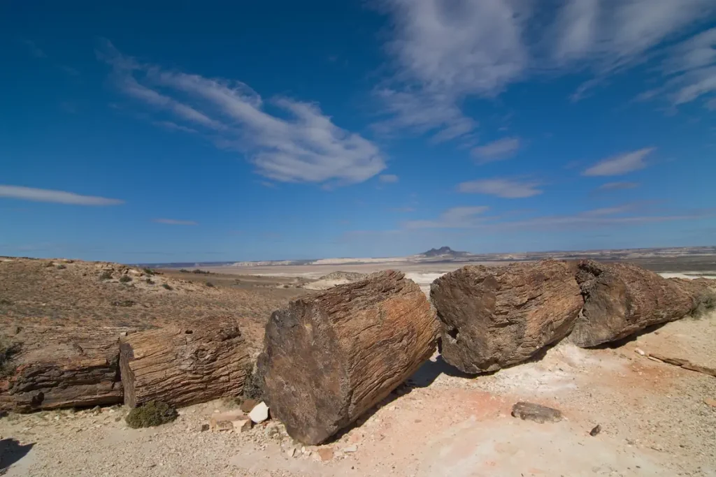
The Patagonian Desert has existed since the Middle Miocene (14-12 million years ago) and came into existence as the Andes rose to the west. Before the rise of the Andes, there were temperate forests in the area.
But then, ash from nearby volcanoes covered the forests and mineral-saturated waters seeped into the logs. This process fossilized the trees and created one of the world’s best-preserved petrified forests.
Today, the area is mostly used for cattle, sheep, and horse husbandry.
7. Kalahari Desert [900,000 km2/347,492 sq mi]
- Type: Subtropical
- Area: 900,000 km2/347,492 sq mi
- Location: Southern Africa
- Countries: Botswana, Namibia, and South Africa

The Kalahari Desert is a large semi-arid sandy savanna in Southern Africa. It covers much of Botswana, and parts of Namibia and South Africa.
Kalahari is actually not that arid and is considered “semi-desert”. Thanks to its low aridity, the Kalahari supports a variety of flora.
It is home to a diverse array of desert-adapted plants and animals, including the legendary black-maned Kalahari lion, cheetah, meerkat, gemsbok, and many migratory birds.
6. Gobi Desert [1,295,000 km2/500,002 sq mi]
- Type: Cold winter
- Area: 1,295,000 km2/500,002 sq mi
- Location: Eastern Asia
- Countries: China and Mongolia

The Gobi desert is located on a plateau roughly 910-1,520 meters (2,990-4,990 feet) above sea level and is also located quite far north. So the winter temperatures are extremely low. Combined with the freezing Siberian winds, these features cause the temperatures in Gobi to reach -40 °C (-40 °F) in winter.
Contrarily, summers are short but extremely hot. Temperatures can rise up to 45 °C (113 °F) in summer.
Despite these harsh conditions, the Gobi and surrounding regions sustain many animals, including black-tailed gazelles, marbled polecats, wild Bactrian camels, Mongolian khulan, and sand plovers.
The region is also occasionally visited by snow leopards, Gobi bears, and wolves. With 30 species distributed across its southern Mongolian border, Lizards are especially well-adapted to the climate of the Gobi.
The most common vegetation in the Gobi desert is shrubs adapted to drought.
Several large nature reserves have been established in the Gobi, including Gobi Gurvansaikhan National Park, Great Gobi A, and Great Gobi B Strictly Protected Area.
5. Arabian Desert [2,330,000 km2/899,618 sq mi]
- Type: Subtropical
- Area: 2,330,000 km2/899,618 sq mi
- Location: Western Asia
- Countries: Iraq, Jordan, Kuwait, Oman, Qatar, Saudi Arabia, the United Arab Emirates, and Yemen
The Arabian Desert is the largest desert in Asia. It occupies almost the entire Arabian Peninsula.
It is an extremely arid and hot desert with little biodiversity. Gazelles, oryxes, sand cats, and spiny-tailed lizards are some of the desert-adapted species that survive in this extreme environment. There are also about 900 species of plants.
The Arabian Desert is actually an extension of the Sahara, on another continent.
4. Great Australian Desert [2,700,000 km2/1,042,476 sq mi]
- Type: Subtropical
- Area: 2,700,000 km2/1,042,476 sq mi
- Location: Australia
- Countries: Australia

The Great Australian Desert covers 18% of the Australian mainland. It receives relatively high rates of rainfall or around 250 mm (9.84 inches) on average, but due to the high evapotranspiration (see notes 1), it is still a very arid region.
Indigenous Australians have lived in the desert for at least 50,000 years and occupied all Outback regions, but today, it is mostly uninhabited.
The Great Australian Desert has the largest population of feral camels in the world. Their population is estimated at over one million.
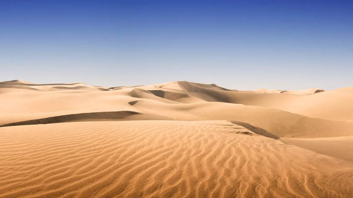
3. Sahara [9,200,000 km2/3,552,140 sq mi]
- Type: Subtropical
- Area: 9,200,000 km2/3,552,140 sq mi
- Location: Eastern Africa, Middle Africa, Northern Africa, and Western Africa
- Countries: Algeria, Chad, Egypt, Eritrea, Libya, Mali, Mauritania, Morocco, Niger, Sudan, Tunisia, and Western Sahara (see notes 2)
Sahara is the largest sand desert or “hot desert” in the world. It is so iconic that most people think Sahara when they heard the word “desert”.
Even its name “Sahara” is derived from the Arabic word for “desert” in the feminine irregular form.
Sahara’s central parts are extremely arid. But, the northern and southern reaches, also the highlands have areas of sparse grassland and desert shrub.
Sahara is extremely hot, but at least two instances of snowfall have been recorded: in February 1979 and December 2016, both in the town of Ain Sefra.
Since it is so big, it has several distinct ecoregions with variations in temperature, rainfall, elevation, and soil. These regions harbor distinct populations of plants and animals.
Among the mammal species still found in the Sahara are the gerbil, jerboa, Cape hare, and desert hedgehog; Barbary sheep and scimitar-horned oryx; Dorcas gazelle, dama deer, and Nubian wild ass; Anubis baboon; spotted hyena, common jackal, and Rüppell’s fox (also called Rüppell’s sand fox); and Libyan striped weasel and slender mongoose. The adorable Fennec Fox also lives in Western Sahara.
Including resident and migratory populations, the birdlife of the Sahara exceeds 300 species with resident and migratory populations.
2. Arctic [13,900,000 km2/5,366,820 sq mi]
- Type: Polar ice and tundra
- Area: 13,900,000 km2/5,366,820 sq mi
- Location: Eastern Europe, Northern America, Northern Asia, Northern Europe
- Countries: Canada, Finland, Greenland, Iceland, Jan Mayen, Norway, Russia, Svalbard, Sweden, and the United States

The northernmost part of Earth, the Arctic is considered a vast, cold desert. Land within the Arctic region has seasonally varying snow and ice cover, with predominantly treeless permafrost (permanently frozen underground ice) containing tundra.
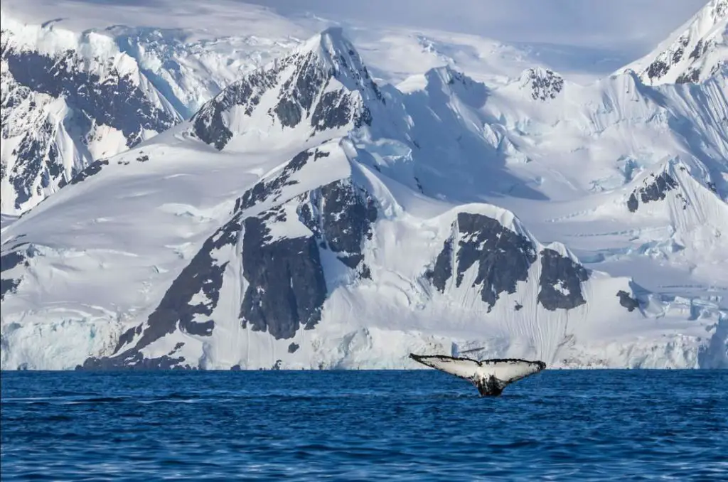
1. Antarctica [14,200,000 km2/5,482,651 sq mi]
- Type: Polar ice and tundra
- Area: 14,200,000 km2/5,482,651 sq mi
- Location: Antarctica
- Countries: None
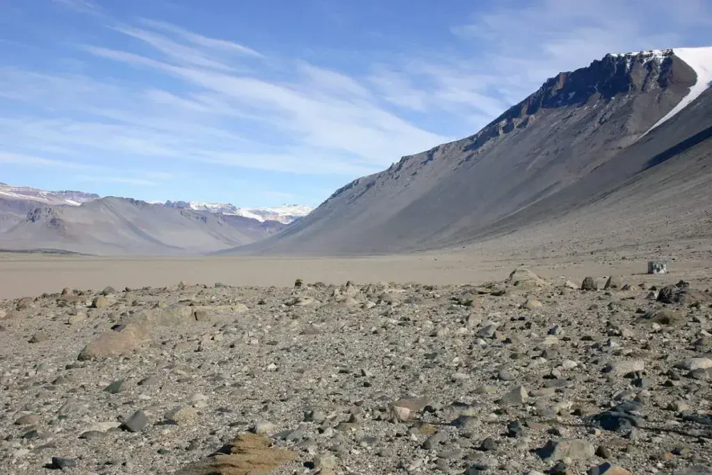
Antarctica is the southernmost continent and a virtually uninhabited, ice-covered landmass. It is the largest desert on Earth. It is the driest, windiest, and coldest continent.
It also has the highest average elevation of all the continents: 8,200 feet (2500 meters).
Antarctica is mostly covered by ice, but there are some iceless regions, the most famous is McMurdo Dry Valleys, which is the driest place on Earth.
There are also sand dunes in Antarctica. The largest recorded one was 70 meters (230 feet) high and more than 200 meters (650 feet) wide and was located in the McMurdo Dry Valleys.
Related: 36 Interesting Antarctica Facts
Notes
- Evapotranspiration is the combined process by which water moves from the earth’s surface into the atmosphere. It covers water evaporation (movement of water to the air directly from soil, canopies, and water bodies) and transpiration (movement of water from the soil, through roots and bodies of vegetation, on leaves, and then into the air).
- Western Sahara is a disputed territory on the northwest coast and in the Maghreb region of North and West Africa. About 20% of the territory is controlled by the self-proclaimed Sahrawi Arab Democratic Republic (SADR), while the remaining 80% of the territory is occupied and administered by neighboring Morocco.
Sources
- List of deserts by area on Wikipedia
- Registan Desert on Wikipedia
- Thar Desert on Wikipedia
- Eastern Highlands & Ogaden Desert on the My Africa Adventure website
- Taklamakan Desert on Wikipedia
- Kyzylkum Desert on Wikipedia
- Sonoran Desert on Wikipedia
- Colorado Plateau on Wikipedia
- Karakum Desert on Wikipedia
- Chihuahuan Desert on Wikipedia
- Great Basin Desert on Wikipedia
- Syrian Desert on Wikipedia
- Patagonian Desert on Wikipedia
- Kalahari Desert on Wikipedia
- Arabian Desert on Wikipedia
- Sahara on Wikipedia
- Animal life in Sahara on the Encyclopedia Britannica website

- How Many Elephants are Left in the World in 2025? - August 17, 2025
- Moon Landings: All-Time List [1966-2025] - February 2, 2025
- What Is Max-Q and Why Is It Important During Rocket Launches? - January 16, 2025