On September 11, 2001, during the 9/11 attacks, NASA astronaut Frank Culbertson took this photo from the International Space Station (ISS) of smoke rising from the Twin Towers of the World Trade Center in New York City.
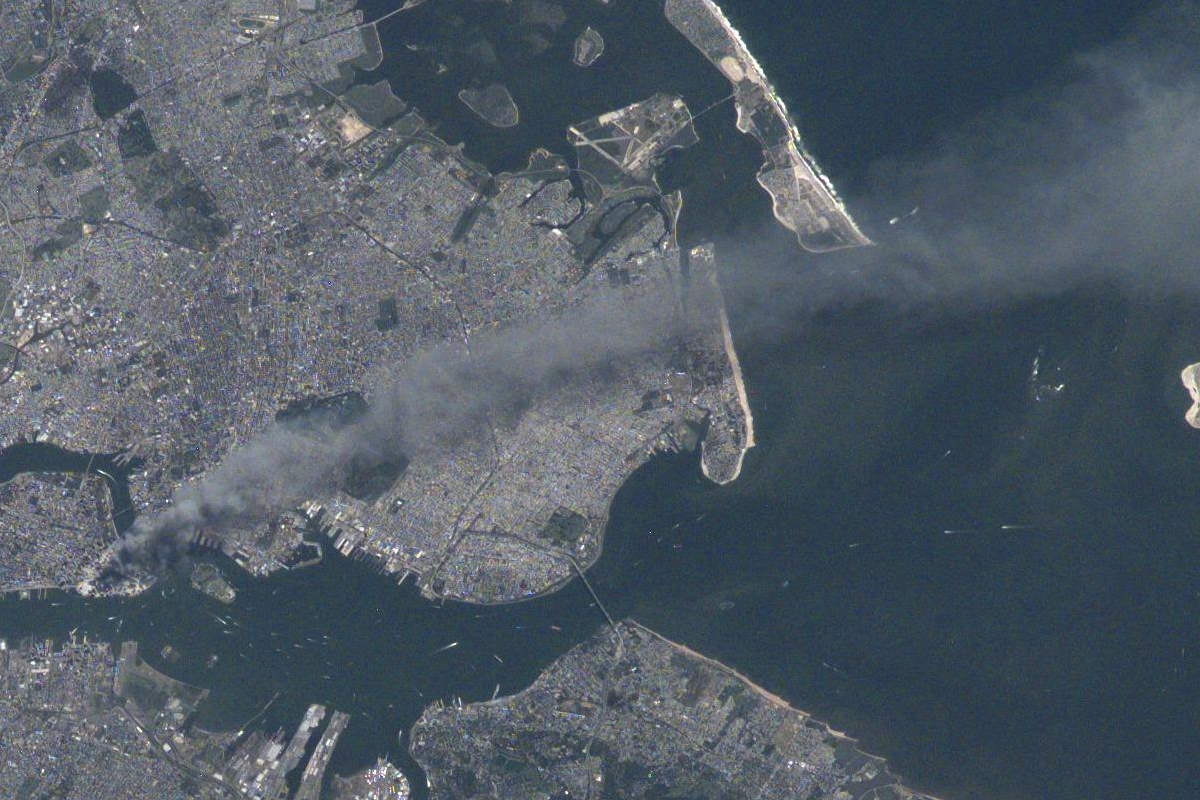
On September 11, 2001, during the 9/11 attacks, NASA astronaut Frank Culbertson took this photo from the International Space Station (ISS) of smoke rising from the Twin Towers of the World Trade Center in New York City.
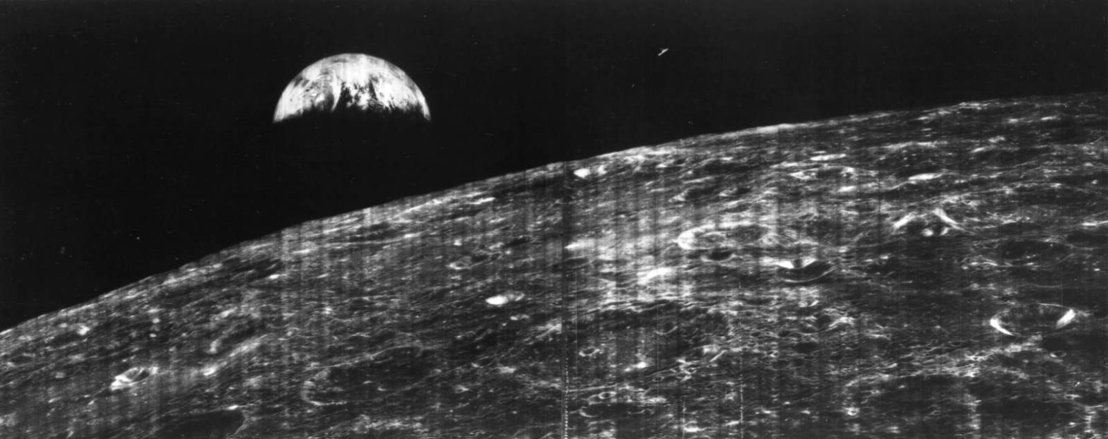
On August 23, 1966, NASA’s Lunar Orbiter 1 robotic spacecraft took the first photograph of Earth from the Moon’s orbit.
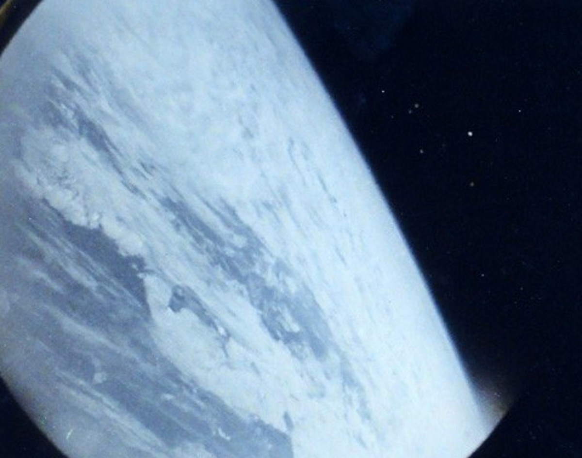
On August 6, 1961, Soviet cosmonaut Gherman Titov took the first photo of Earth from space taken by a person. It was also the first color image of Earth from space. Titov became the first photographer from space.
This spaceflight was the first crewed spaceflight lasting over 24 hours. Titov was also the first to suffer from space sickness.
Much of the technology common today that we take for granted originates from the moon landing. Here are 10 moon-landing innovations that changed life on Earth.
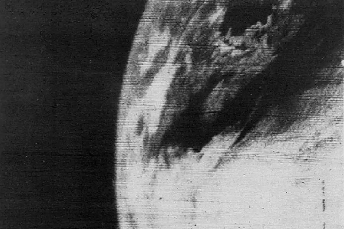
On April 1, 1960, NASA’s TIROS-1 (Television Infrared Observation Satellites-1), the first weather satellite was launched from Cape Kennedy and captured the first television picture of Earth from space.

On March 30, 2020, NASA astronaut Mark Vande Hei returned to Earth after 355 days aboard the International Space Station (ISS). He broke the record for the longest spaceflight by an American astronaut. In a video published by the NASA Johnson channel, Vande Hei answers social media questions on March 10 and reflects on his record-breaking spaceflight.
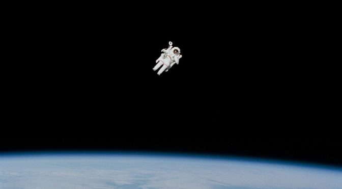
On February 7, 1984, during the STS-41-B (the tenth NASA Space Shuttle mission and the fourth flight of the Space Shuttle Challenger), NASA astronaut Bruce McCandless II (June 8, 1937 – December 21, 2017) made the first-ever untethered free flight using the Manned Maneuvering Unit (see notes 1). With a distance of 98 meters (320 feet) from the space shuttle, he also broke the untethered spacewalking record.

Satellite imagery captures Tonga’s Hunga volcano erupting. The Hunga Tonga-Hunga Ha’apai volcano erupted for the second time in 2 days and the National Oceanic and Atmospheric Administration’s (NOAA) GOES-West satellite captured imagery of the eruption. The eruption also triggered a tsunami that hit the South Pacific Kingdom of Tonga. This time-lapse video composed of images taken from space shows how powerful the eruption was.
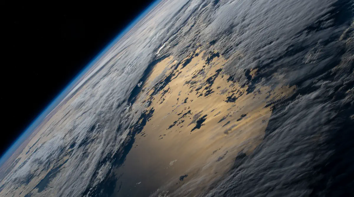
Here are the top 10 most beautiful Earth photos taken from the International Space Station in 2021. Which one is your favorite? Or if your favorite image was not listed here, please leave a comment below. To see all images taken from the ISS and published by NASA, visit Space Station Images webpage.
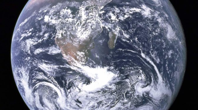
On December 7, 1972, the crewmembers of Apollo 17 spacecraft en route to the Moon took a photo of Earth from space, at a distance of about 45,000 kilometers (28,000 miles). This image, with the official NASA designation AS17-148-22727, became known as “The Blue Marble”. It remains one of the most iconic photos of Earth taken from space.