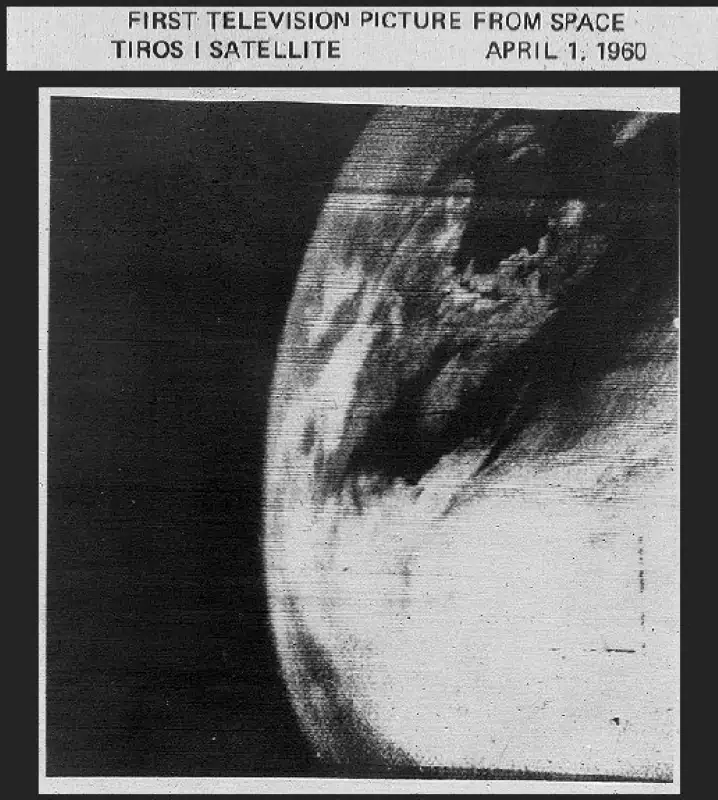
On April 1, 1960, NASA’s TIROS-1 (Television Infrared Observation Satellites-1), the first weather satellite was launched from Cape Kennedy and captured the first television picture of Earth from space.
Today’s (April 1) story of what happened this day in Science, Technology, Astronomy, and Space Exploration history.
The TIROS Program (Television Infrared Observation Satellite) was NASA’s first experimental step to determine if satellites could be useful in the study of the Earth. Since satellites were a new technology, at that time, the effectiveness of satellite observations was still unproven.
But, the TIROS program was extremely successful, providing the first accurate weather forecasts based on data gathered from space. TIROS began continuous coverage of the Earth’s weather in 1962 and was used by meteorologists worldwide. The program’s success with many instrument types and orbital configurations lead to the development of more sophisticated meteorological observation satellites.
The first television picture of Earth from space
Over its two-and-a-half-month lifespan, TIROS-1 returned 23,000 photos of the Earth, 19,000 of them usable for weather analysis.
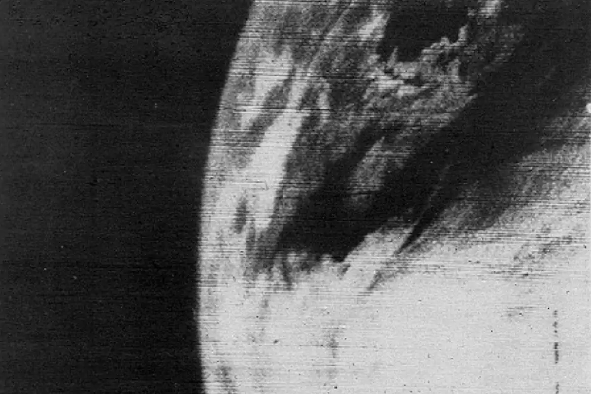
The image below was the first image that TIROS-1 returned, the first television picture of Earth from space.
TIROS-1, the first weather satellite
The Television InfraRed Observational Satellite 1 (TIROS-1) was the first weather satellite (see notes 1), the first of a series of Television Infrared Observation Satellites placed in low-Earth orbit.
It was the first experimental step of NASA to determine if satellites could be useful in the study of the Earth.
Launched into orbit from Cape Canaveral Space Launch Complex 17A on April 1, 1960, at 11:40:09 UTC by a Thor Able II rocket, TIROS-1 performed normally until June 15, 1960, when an electrical power failure prevented further useful TV transmission.
It was equipped with two TV cameras, and was operational for only 78 days but demonstrated the feasibility of monitoring planet Earth’s cloud cover and weather patterns from space.
TIROS satellites eventually began continuous coverage in 1962 and enabled accurate worldwide weather forecasts and alerts. This image is the first TIROS TV image, taken from an altitude of about 700 kilometers (435 miles).
Crude by contemporary standards, the satellite represents the beginning of what is still one of the most important continuing applications of space technology.
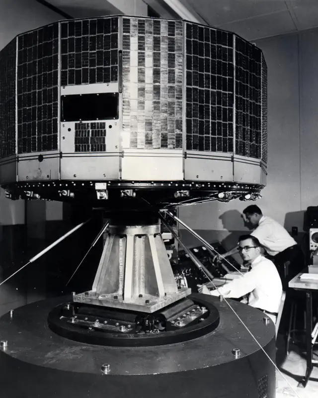
Two television cameras were housed in the craft, one low-resolution and one high-resolution. A magnetic tape recorder for each camera was supplied for storing photographs while the satellite was out of range of the ground station network.
The antennas consisted of four rods from the base plate to serve as transmitters and one vertical rod from the center of the top plate to serve as a receiver.
TIROS-1 was spin-stabilized and space-oriented (not Earth-oriented). Therefore, the cameras were only operated while they were pointing at the Earth when that portion of the Earth was in sunlight.
The video systems relayed thousands of pictures containing cloud-cover views of the Earth. Early photographs provided information concerning the structure of large-scale cloud regimes.
TIROS-1 was operational for only 78 days but proved that satellites could be a useful tool for surveying global weather conditions from space.
April 1 in Science, Technology, Astronomy, and Space Exploration history
- 1960: The first television picture of Earth from space
- 1960: The first weather observation satellite [TIROS-1] was launched
Notes
- Launched on February 17, 1959, the Vanguard 2 satellite was the first experimental/prototype weather satellite.
Sources
- TIROS-1 on Wikipedia
- “TIROS, the Nation’s First Weather Satellite” on the NASA website
- “The Television Infrared Observation Satellite Program (TIROS)” on the NASA Science website

- How Many Elephants are Left in the World in 2025? - August 17, 2025
- Moon Landings: All-Time List [1966-2025] - February 2, 2025
- What Is Max-Q and Why Is It Important During Rocket Launches? - January 16, 2025