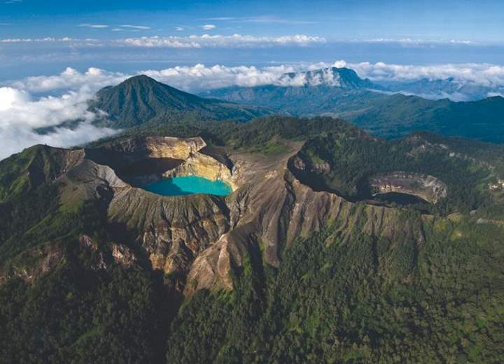
Spanning the length and breadth of our magnificent planet, nature’s wonders never cease to amaze. From the well-known to the undiscovered, these marvels showcase the staggering beauty and diversity of Earth’s landscapes. Some of these natural wonders are famous worldwide, while others remain hidden gems. Whether formed by the relentless power of water, wind, or tectonic forces, each phenomenon has a unique story to tell. Let’s embark on a journey to explore 10 such fascinating natural wonders around the world.
The age of the Earth is approximately 4.54 billion years. For all these years, our planet has been a work in progress: water, wind, air pressure, minerals, heat, and even extraterrestrial forces like meteors and comets mold and shape our environment, and create all manner of strange formations. Some of them are really beautiful: we call them “Natural wonders”. Some natural wonders are really famous, for example
10 Beautiful Natural Wonders Around the World
1. Sea Cave in Benagil Beach [Algarve, Portugal]
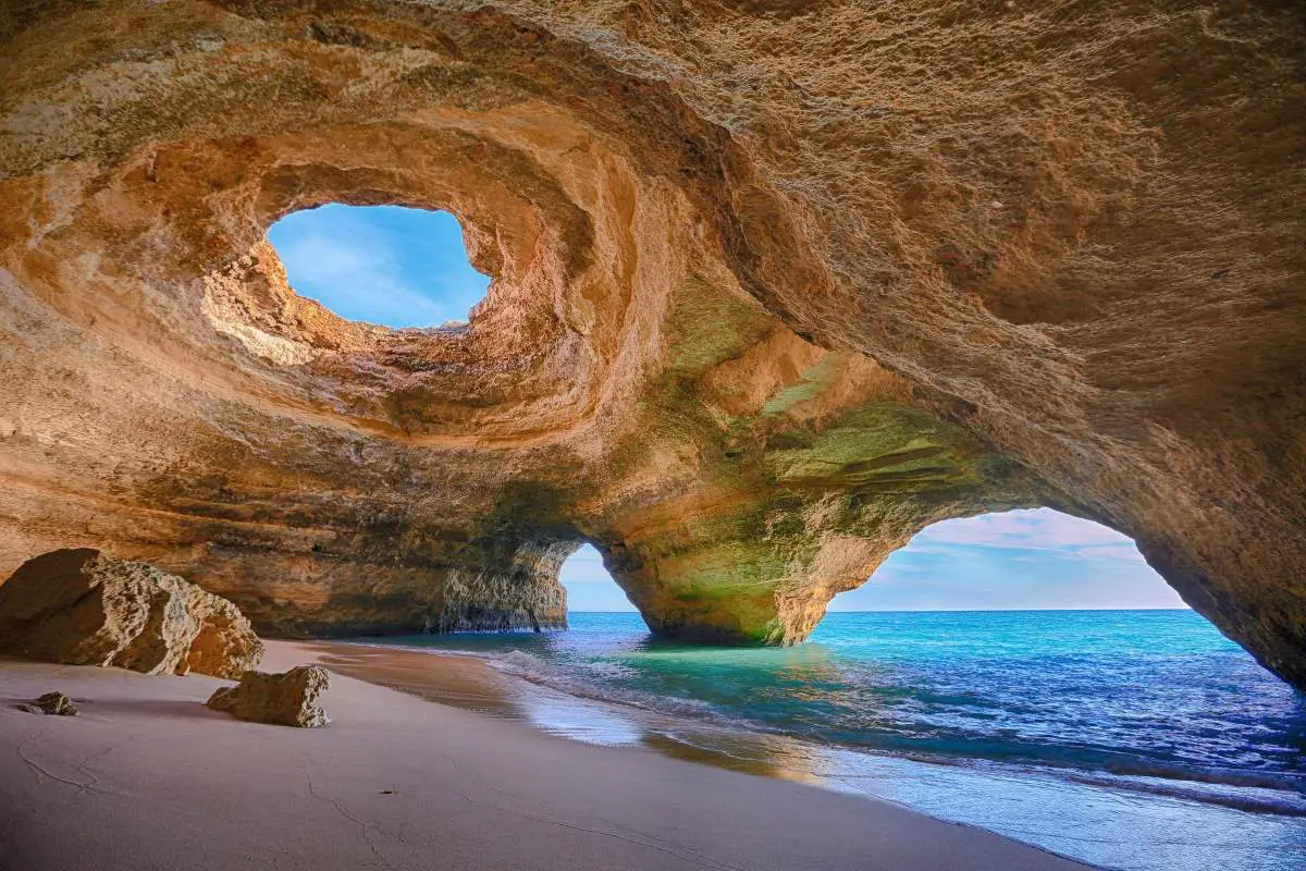
Located along the coastline of Portugal’s Algarve region, the Benagil Sea Cave is a stunning natural wonder that has captivated visitors from around the world. This impressive cave, sculpted by the relentless forces of nature, is characterized by a domed roof with a central, circular opening, allowing sunlight to pour into the sandy beach below.
The Benagil Sea Cave is accessible only by sea. Kayaking, swimming, or taking a boat tour are the most common ways to reach it. A number of boat trips to visit the caves are offered by local companies based at Benagil Beach. It’s important to note that swimming is a considerable distance from the main beach and should only be attempted by strong swimmers in good weather conditions.
The sight that greets visitors inside the cave is truly breathtaking. When the sun is directly overhead, rays of light cascade down, illuminating the sand and the turquoise waters, offering an ethereal experience that is hard to match. The cave’s natural architecture, combined with the play of light, creates a magical and serene atmosphere that leaves a lasting impression on all who visit.
Benagil is a small Portuguese village on the Atlantic Ocean in Lagoa Municipality and the Freguesia of Carvoeiro (Lagoa). Until
2. Giant’s Causeway [Northern Ireland]
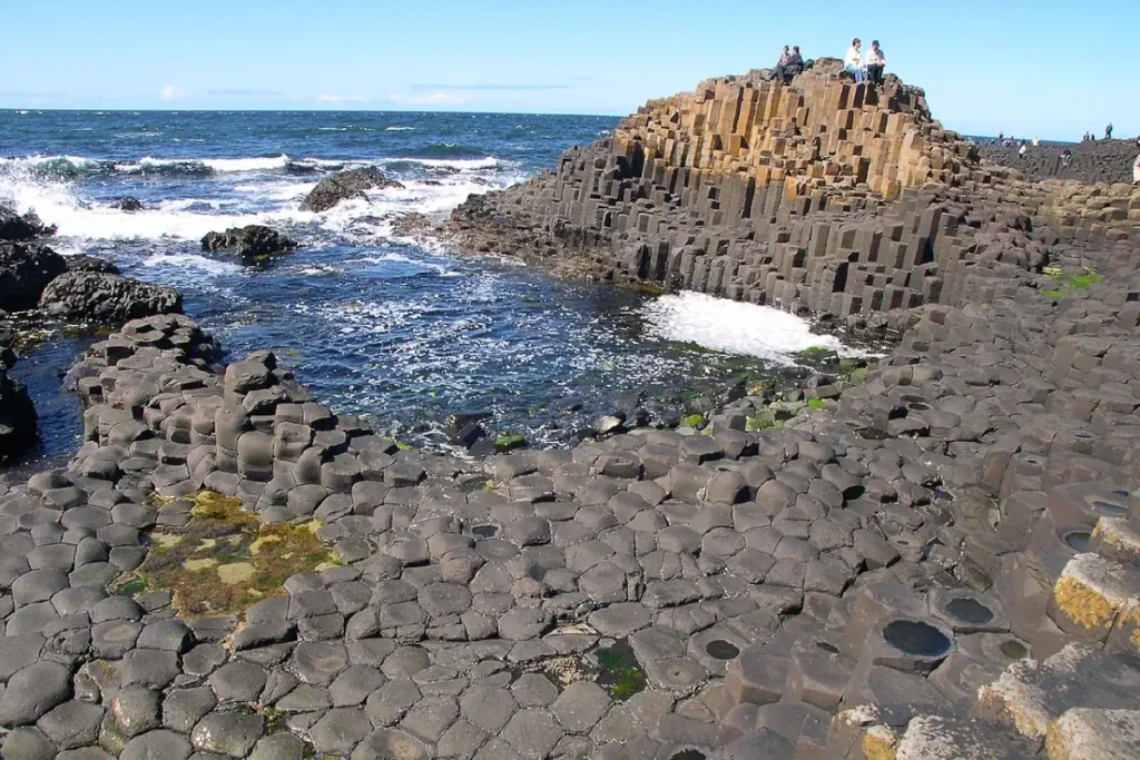
It is an area of about 40,000 interlocking basalt columns that interlock to form what looks like a walkway fit for a colossus, resulting from an ancient volcanic eruption. The Giant’s Causeway is located in County Antrim on the northeast coast of Northern Ireland, about three miles (4.8 km) northeast of the town of Bushmills. It was declared a World Heritage Site by UNESCO in 1986.
The stones, mostly hexagonal in shape (although there are also some with four, five, seven, or eight sides), formed 60 million years ago when underground lava flows cooled into formations as tall as 39 feet (11.9 meters) high and 18 inches (45.7 cm) in diameter. It was comparatively recently (about 15,000 years ago) that the soil around the seaside stones eroded and they became visible above ground.
The legend behind the Giant’s Causeway
According to legend, the columns are the remains of a causeway built by a giant. The story goes that the Irish giant Fionn Mac Cumhaill (Finn MacCool), from the Fenian Cycle of Gaelic mythology, was challenged to a fight by the Scottish giant Benandonner. Fionn accepted the challenge and built the causeway across the North Channel so the two giants could meet.
In one version of the story, Fionn defeats Benandonner. In another, Fionn hides from Benandonner when he realizes that his foe is much bigger than he. Fionn’s wife, Oonagh, disguises Fionn as a baby and tucks him into a cradle. When Benandonner sees the size of the ‘baby’, he reckons that its father, Fionn, must be a giant among giants. He flees back to Scotland in fright, destroying the causeway behind him so that Fionn cannot follow. Across the sea, there are identical basalt columns (a part of the same ancient lava flow) at Fingal’s Cave on the Scottish isle of Staffa, and it is possible that the story was influenced by this.
The discovery of the Giant’s Causeway was announced to the wider world in 1693 by the presentation of a paper to the Royal Society from Sir Richard Bulkeley. The site first became popular with tourists during the nineteenth century, particularly after the opening of the Giant’s Causeway Tramway, and only after the National Trust took over its care in the 1960s were some of the vestiges of commercialism removed.
Visitors can walk over the basalt columns which are at the edge of the sea, a half-mile walk from the entrance to the site.
3. Stone Forest [China]
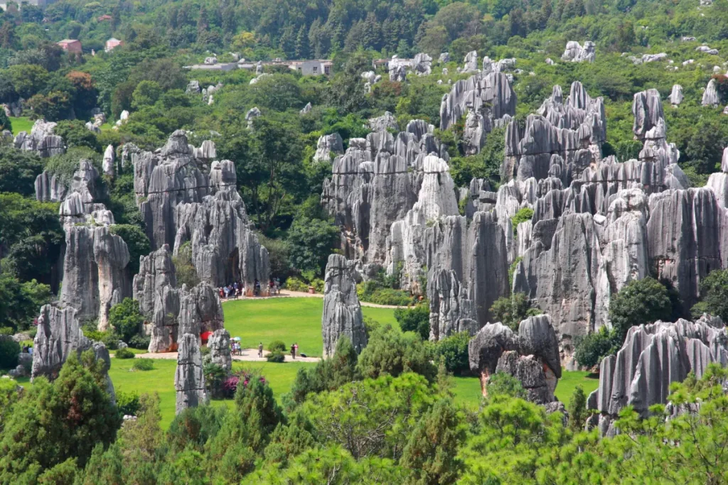
The Stone Forest or Shilin is a notable set of limestone formations located in Shilin Yi Autonomous County, Yunnan Province, People’s Republic of China, approximately 120 km (75 miles) from the provincial capital Kunming.
Around 270 million years ago, the area, which spans nearly 200 square miles (500 km2), was underwater, and the seafloor was covered with limestone sediment. Gradually, the seabed rose and the water dried up. As rain and wind eroded the weaker rock, the stronger limestone spires began to take shape. Now they rise skyward, surrounded by leafy trees.
The Stone Forest is not only a geological wonder, but it’s also home to the Sani people, a branch of the Yi ethnic group in China. They have a rich history and vibrant culture, adding further allure to the area.
According to legend, the forest is the birthplace of Ashima, a beautiful girl of the Yi people. After falling in love she was forbidden to marry her chosen suitor and instead turned into a stone in the forest that still bears her name. Each year on the 24th day of the sixth lunar month, many Yi people celebrate the Torch Festival, which features folk dances and wrestling competitions.
4. Colca Canyon [Peru]

Colca Canyon is a canyon of the Colca River in southern Peru, often considered one of the deepest in the world. It is a popular tourist destination known for its vibrant cultural history, stunning natural beauty, and diverse wildlife.
Geographically, the canyon is situated about 160 kilometers (100 miles) northwest of Arequipa, Peru’s second-largest city. It reaches a depth of approximately 4,160 meters (13,650 feet), which is more than twice as deep as the Grand Canyon in the United States. Despite being less known internationally, it is one of the most spectacular geological features in South America.
The region has been inhabited for thousands of years, and today is home to the Collaguas and the Cabanas, native people who still maintain many of their ancestral traditions. They are known for their intricate, colorful clothing and impressive pre-Inca terraces used for cultivating crops on the steep sides of the canyon.
Colca Canyon offers various recreational activities for visitors. These include trekking, mountain biking, and river rafting. Perhaps one of the most appealing draws is the opportunity to view the Andean Condor in its natural habitat. The region is home to the largest bird species on earth, which can be seen at close quarters as it soars above the canyon walls.
The region also features several hot springs, traditionally used for their therapeutic properties, and the towns of Chivay and Cabanaconde offer services for tourists, including accommodations, dining, and guided tours.
One important site to mention in the Colca Canyon region is the Cruz del Condor or “Cross of the Condor.” It’s a viewpoint where visitors often go to watch the Andean condors glide on the thermals rising from the canyon. At this point, the canyon floor is 3,960 feet (1,200 meters) below the rim of the canyon.
One of the iconic features of the Colca Canyon is its agricultural terraces. These are ancient, pre-Incan constructions that are still in use today and they contribute significantly to the stunning beauty of the landscape.
![Devil's Pool [Victoria Falls]](https://ourplnt.com/wp-content/uploads/2016/07/Devil-Pool-Victoria-Falls-1024x576.jpg)
Related: 10 Strange Places in the World
5. Puerto Princesa Subterranean River [Philippines]
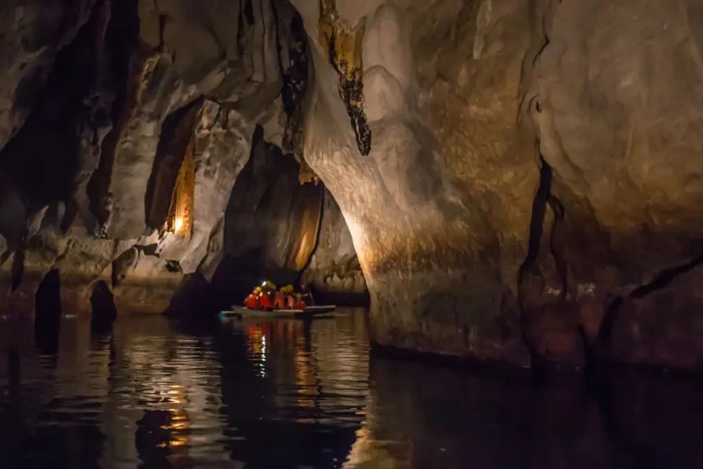
The Puerto Princesa Subterranean River, also known as the Puerto Princesa Underground River, is located in the Saint Paul Mountain Range on the western coast of the island of Palawan, in the Philippines. It was listed as a UNESCO World Heritage Site in 1999, and in 2012, it was designated as one of the New 7 Wonders of Nature.
The river is one of the longest navigable underground rivers in the world, stretching approximately 8.2 kilometers (5.1 miles) from the sea directly into the cave before flowing into the South China Sea. However, the total length of the cave is much longer, over 24 kilometers (15 miles), containing several large chambers, some of which are up to 120 meters (390 feet) in width and 60 meters (200 feet) in height.
The park that houses the river, the Puerto Princesa Subterranean River National Park, spans 22,202 hectares and features a full mountain-to-sea ecosystem. It is home to a range of biodiversity, including many species that are endemic to the island.
The cave system features impressive formations of stalactites and stalagmites, and visitors can navigate through the caverns on guided paddle boat tours. The inside of the cave is notably dark, and the air is often filled with the echoing sounds of bats and swiftlets (a type of bird), which inhabit the cave.
6. Marble Caves [Chile]
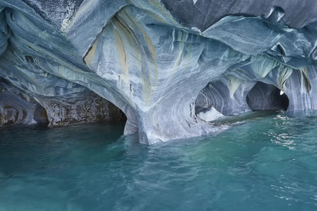
The Marble Caves, also known as the Marble Cathedral or Capillas de Mármol, are a striking geological formation located in the General Carrera Lake, which spans the border between Argentina and Chile. The caves are in the Patagonia region on the Chilean side.
They were formed by wave action over 6,000 years. The calcium carbonate marble from which the caves are formed is a metamorphic rock, created by heat and pressure over hundreds of millions of years. Over time, the water’s wave action washed against the calcium carbonate, creating the smooth, swirling patterns that make these caves so visually stunning.
The color of the caves can change depending on the time of year and the water level in the lake. When the water levels are high, the caves reflect the blue color of the water. When water levels are low, the caves have more grey or white color.
To visit the Marble Caves, one of Chile’s most popular natural wonders, most people travel to the town of Puerto Rio Tranquilo, where boat tours are offered. The journey includes a ride across the azure waters of the lake, offering views of not just the caves, but also the stunning Patagonian landscape.
Related: 10 Recently Lost Natural Wonders
7. The Eye of the Sahara [Mauritania]
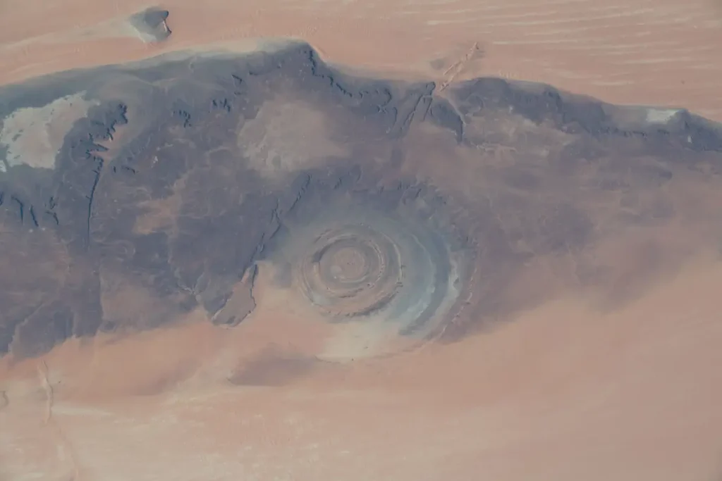
The Eye of the Sahara, also known as the Richat Structure, is a striking circular geological formation in the Sahara desert in northwestern Mauritania. From the ground, it appears as a series of concentric rings, but the full impact of its near-perfect circular symmetry can only be appreciated from space. It’s so large and distinct that early space missions used it as a landmark.
The structure measures approximately 40 kilometers (25 miles) across and was initially thought to have been caused by a meteorite impact. However, subsequent research has dismissed that theory. Today, the most widely accepted explanation is that it’s a deeply eroded geologic dome.
Geologic domes occur when molten rock beneath the surface lifts up a layer of rock. Over time, erosion removes the top layers of the dome, revealing the more resistant layers underneath. This process results in the concentric circles of different rock types that we see today. The darker rocks on the outer edges are the oldest, while the lighter rocks in the center are the youngest.
Despite its stark beauty, the Richat Structure remains relatively unexplored due to its remote desert location. It’s not easy to reach, and there are few facilities nearby for visitors. Nevertheless, it’s a fascinating natural wonder that continues to captivate geologists and space enthusiasts alike.
8. Salar de Uyuni [Bolivia]
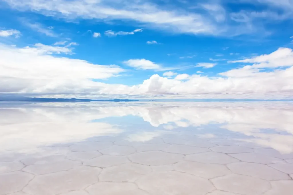
Salar de Uyuni, located in southwest Bolivia near the crest of the Andes, is the world’s largest salt flat, spanning an area of over 10,000 square kilometers or approximately 4,000 square miles. This massive expanse of white salt is the result of transformations between several prehistoric lakes that went through evaporation and re-flooding processes.
The surface of Salar de Uyuni is extraordinarily flat, with average altitude variations within one meter over the entire area. This attribute makes the Salar an ideal object for calibrating the altimeters of Earth observation satellites.
Apart from the vast white expanse of salt, Salar de Uyuni is also known for its extraordinarily rich reserves of lithium. It contains between 50% to 70% of the world’s lithium reserves, which are in the process of being extracted.
Another remarkable feature of the Salar is its transformation during the rainy season (usually from December to April). When a thin layer of water collects on the surface, it turns into an enormous mirror, reflecting the sky so perfectly that it’s hard to tell where the sky ends and the Earth begins. This creates a surreal, dream-like landscape that’s a photographer’s dream.
One can also find islands in this sea of salt, like Incahuasi Island and Fish Island. These islands, which are the tops of ancient volcanoes that were submerged by the lake long ago, are covered in giant cacti and are home to unusual and fragile ecosystems.
Visiting the Salar, one can expect to see unique fauna, such as three species of South American flamingos and the Andean fox. The area is also home to ancient civilizations, and there are many archaeological and anthropological sites of interest.
While it is a popular tourist destination, it’s important for visitors to remember to respect the unique and delicate environment of the Salar de Uyuni. Despite its stark, otherworldly appearance, it is a vibrant ecosystem and an important cultural heritage site.
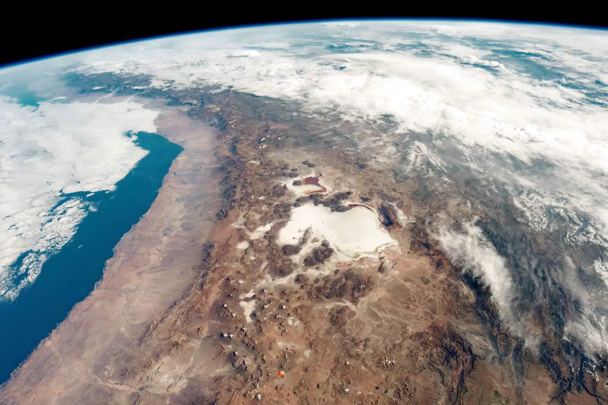
Related: Salar de Uyuni Salt Flat from Space
9. Rainbow-colored Danxia landforms [Chinese rainbow mountains]
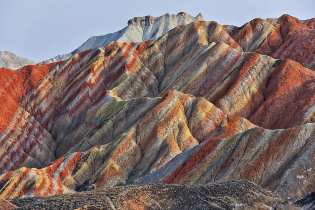
Danxia landforms, also known as “Chinese rainbow mountains,” are a unique type of landscape found in several regions of China, most notably in the Zhangye National Geopark in Gansu Province. These natural wonders are characterized by their beautiful and colorful layered rock formations.
The term “Danxia” refers to a type of petrographic geomorphology, which describes the appearance and formation of the landscape. Danxia landforms are formed from red-colored sandstones and conglomerates that have been eroded over millions of years into a series of mountains surrounded by curvaceous cliffs and many unusual rock formations.
The rainbow colors of the Danxia landforms have been created by the layering of different types of stone and minerals. Over millions of years, geological processes like uplift and weathering, and erosion have exposed these layers, giving the mountains their distinctive multicolored stripes.
Red is the most common color, due to the oxidation of iron minerals in the rock which creates a rusting effect, but there are also layers of yellows, oranges, greens, blues, and whites. The colors are incredibly vibrant and are most striking in the sunlight after a rain shower when the colors appear more saturated.
Several regions with Danxia landforms have been collectively designated as a World Heritage Site by UNESCO, under the name “China Danxia.” The landscapes are a popular tourist attraction, offering stunning views and fascinating insights into the long-term effects of geological processes on the Earth’s surface. They are a testament to the beauty that can be formed through natural processes over millions of years.
10. Pamukkale [Turkey]
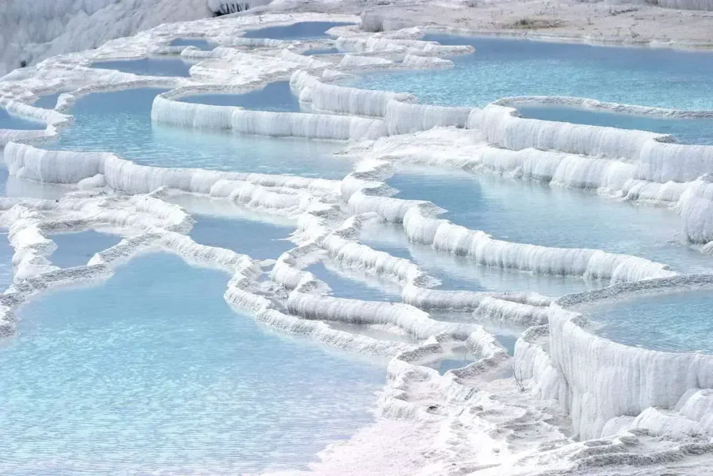
Pamukkale, meaning “cotton castle” in Turkish, is a natural site in Denizli Province in southwestern Turkey. Located in Turkey’s Inner Aegean region, in the River Menderes valley, which has a temperate climate for most of the year, Pamukkale contains hot springs and travertines, terraces of carbonate minerals left by the flowing water.
Pamukkale travertines are perhaps one of the most famous natural wonders in Turkey.
The water that flows from 17 subterranean hot springs into the pools has an extremely high concentration of calcium carbonate, which forms soft deposits when it hits the surface. Those viscous white deposits harden over time until the springs resemble a fountain made of chalk or, as indicated by the translation of Pamukkale, a “cotton castle” visible from more than 20 kilometers (12.5 miles) away.
Pamukkale’s terraces are made of travertine, a sedimentary rock deposited by water from the hot springs.
The ancient Greco-Roman and Byzantine city of Hierapolis was built on top of the white “castle” which is in total about 2,700 meters (8,860 feet) long, 600 meters (1,970 feet) wide, and 160 meters (525 feet) high.
Pamukkale is a UNESCO World Heritage Site.
Sources
- Giant’s Causeway on Wikipedia
- Colca Canyon on Wikipedia
- Puerto Princesa on Wikipedia
- Richat Structure on Wikipedia
- Salar de Uyuni on Wikipedia
- Chocolate Hills on Wikipedia
- Pamukkale on Wikipedia
- How Many Elephants are Left in the World in 2025? - August 17, 2025
- Moon Landings: All-Time List [1966-2025] - February 2, 2025
- What Is Max-Q and Why Is It Important During Rocket Launches? - January 16, 2025

