Categories
Global Warming Climate

Atmospheric Carbon Dioxide Reached the Highest Levels in 800,000 years

According to measurements from Mauna Loa Observatory in Hawaii, with 410.31 ppm (parts per million), the level of carbon dioxide in Earth’s atmosphere hit a new high in April 2018. This is the highest point for the last 800,000 years.

Last year’s (April 2017) value, 409.00 ppm, was also a record high. As you can see in the graph below, which shows recent monthly mean carbon dioxide measured at Mauna Loa Observatory, Hawaii, it’s a continuing trend.

Categories
Climate Astronomy Planet Earth

What would happen if the Earth started spinning backward?

The dynamics of the ocean and the atmosphere are strongly influenced by the Earth’s rotation. Currently, our planet rotates from west to east (prograde, which appears counterclockwise) with a linear velocity of 465.1013 m/s (1674.365 km/h or 1040.40 mph) at the equator. What would happen if the Earth started spinning backward (from east to west)?

Categories
Global Warming Climate

Global Warming: Future Greenhouse Gas Emission Scenarios

The future of our carbon dioxide and greenhouse gas emissions will decide how many degrees planet Earth will be warmer by 2100 (relative to pre-industrial temperatures). Using the data from Climate Action Tracker, the online publication that shows how living conditions are changing, Our World In Data has published a chart showing future greenhouse gas emission scenarios and how each scenario would result in estimated global warming by 2100.

Categories
Astronomy Climate Physics Solar System Space Exploration

Want to Become a Citizen Scientist for NASA? Now you can

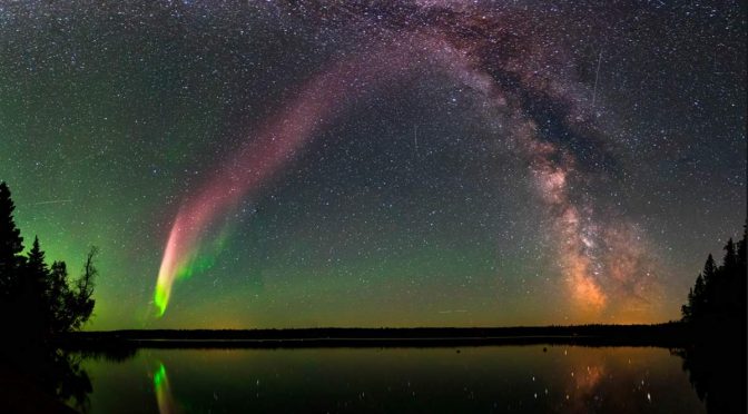
You can help NASA on some projects: for instance, citizen scientists helped NASA identify an aurora-related celestial phenomenon, now called STEVE. Want to become a citizen scientist? You can find projects on the NASA website.

Categories
Climate Life on Earth Places Plants

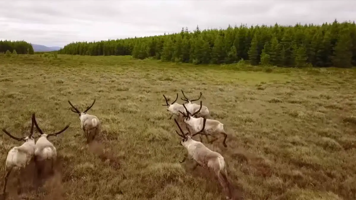
Iceland is growing new forests for the first time in 1,000 years

Iceland was extensively forested when it was first settled. When the Vikings first arrived in the 9th century, the Nordic island was covered in 25 to 40 percent forest, compared to 1% in the present day. In the late 12th century, Ari the Wise (Ari Thorgilsson, 1067-1148 AD), Iceland’s most prominent medieval chronicler, described it in the Íslendingabók (Book of Icelanders (see notes 1) as “forested from mountain to seashore”.

Categories
Climate

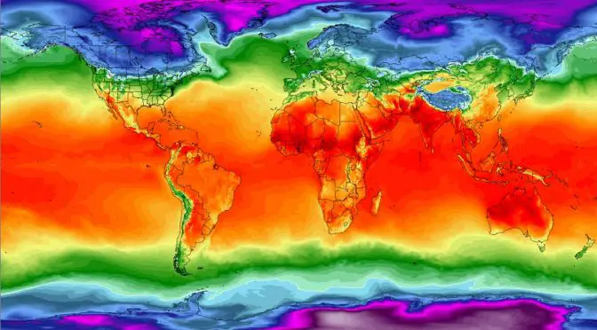
Climate Reanalyzer [Visual Climate and Weather Datasets]

Today I stumbled upon on a beautiful website: the Climate Reanalyzer. In fact, Chris Hadfield, the retired Canadian astronaut and also who was the first Canadian to walk in space, tweeted about the website, saying “The current bulge of cold. Then I visited the website and found it really informative.

Categories
Global Warming Climate Environment

Global Sea-Level Rise Accelerating [New Study]

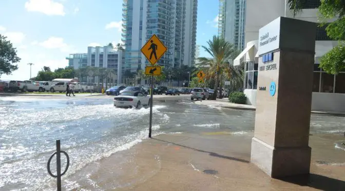
As a result of global warming, the seas warm and ice melts. Naturally, Earth’s oceans have risen steadily – or at least, it was thought so. According to a new study based on 25 years of NASA and European satellite data, rather than increasing steadily, global sea-level rise has been accelerating in recent decades. If this trend continues, by the year 2100, sea-level rise will be around 65 cm (25.6 in), twice as big as previously thought. This is more than enough to cause significant problems for coastal cities.

Satellite altimetry (see notes 1) has shown that since 1993, the global mean sea level has been rising at a rate of ∼3 ± 0.4 millimeters per year. Researchers show that this rate is accelerating at 0.084 ± 0.025 mm/y2, which agrees well with climate model projections. This acceleration is driven mainly by increased melting in Greenland and Antarctica because of global warming. If the sea level continues to change at this rate and acceleration, sea-level rise by 2100 (∼65 cm ± 12 cm, compared with 2005) will be more than double the amount if the rate was constant at 3 mm/y, researchers conclude.
Categories
Climate Earth from Space Places

Snow In Sahara, World’s Hottest Desert

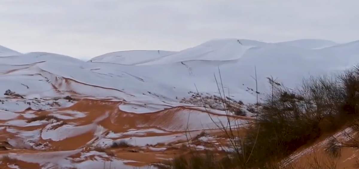
On Sunday, January 07, 2018, the residents of Aïn Séfra, a small town in Algeria, experienced a rare phenomenon: snow in Sahara, the world’s hottest desert. In the video below, published by National Geographic, snow-dusted the desert’s sandy dunes. With temperatures touching 33.8 degrees Fahrenheit (1 °C), this white blanket stayed briefly through the morning before melting away. However, a few residents found the opportunity to enjoy some winter fun.

Categories
Climate Earth from Space

Earth Wind Map: See Current Wind Speeds all over the Earth

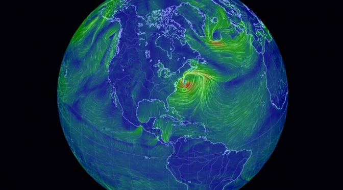
This is so cool! With this tool, called “Earth Wind Map”, an animated map of global wind, weather, and ocean conditions, you can see current wind speeds all over the Earth, in real time!

Categories
Earth from Space Climate Space Exploration

Bomb Cyclone from space [amazing NASA Image]

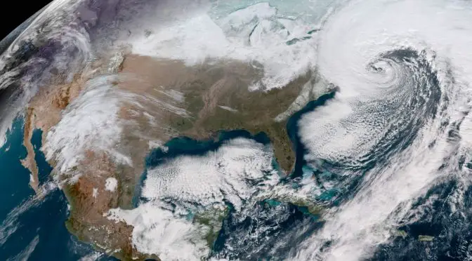
On January 4, 2018, NASA has published an amazing GeoColor (see notes 1) image of the so-called “Bomb Cyclone”, a very powerful storm off the East coast of the United States. It was taken from the National Oceanic and Atmospheric Administration (NOAA) GOES-16 satellite (previously known as GOES-R) (see notes 2).