Categories
Earth from Space Space Exploration

Amazing Time-Lapse Video Showing Earth from the ISS

European Space Agency has published an amazing time-lapse video showing the Earth from the International Space Station (ISS). The space agency wrote “Join ESA astronaut Alexander Gerst for a quick flight from the USA to Africa aboard the International Space Station in this time-lapse filmed 12.5 times faster than actual speed.” You can watch that breathtaking video below:

Categories
Geography Climate Earth from Space Global Warming

18 Largest Islands on Earth

An island or isle is any piece of sub-continental land that is surrounded by water. It is believed that there are over 100,000 islands in the world. It’s difficult to put a figure to the exact number as there are different kinds of them in various water bodies including oceans, seas, lakes, and rivers. There is even an island within a lake that is situated on an island located in a lake on an island. Only 322 of them are larger than 1000 km2 (386 sq mi). Here are the top 18 largest islands on Earth. Why 18? Because this is the number of islands that have a land area of greater than 100,000 square kilometers (38,610 square miles).

Categories
Earth from Space Space Exploration

Astronaut describes seeing Earth from space for the first time

In a video published by the European Space Agency on Twitter, retired American astronaut Scott Kelly describes seeing Earth from space for the first time.

Categories
Earth from Space Moon Landing Space Exploration

Incredible Images of Earth and Moon [Captured by Chinese Satellite]

On his Twitter account, Andrew Jones, a journalist reporting on China’s space program and related activities, has published amazing images of the Earth and the Moon captured from China’s Queqiao lunar communications relay satellite, a key component of Chang’e 4 lunar landing mission.

Categories
Earth from Space Space Exploration

An amazing view of Earth by astronaut Ricky Arnold

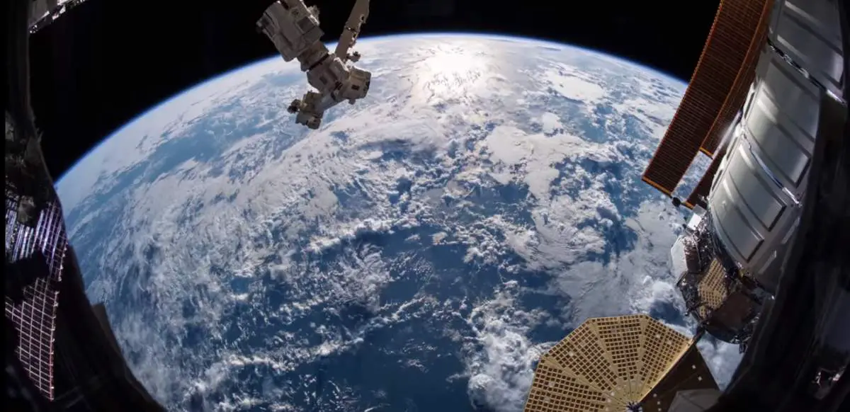
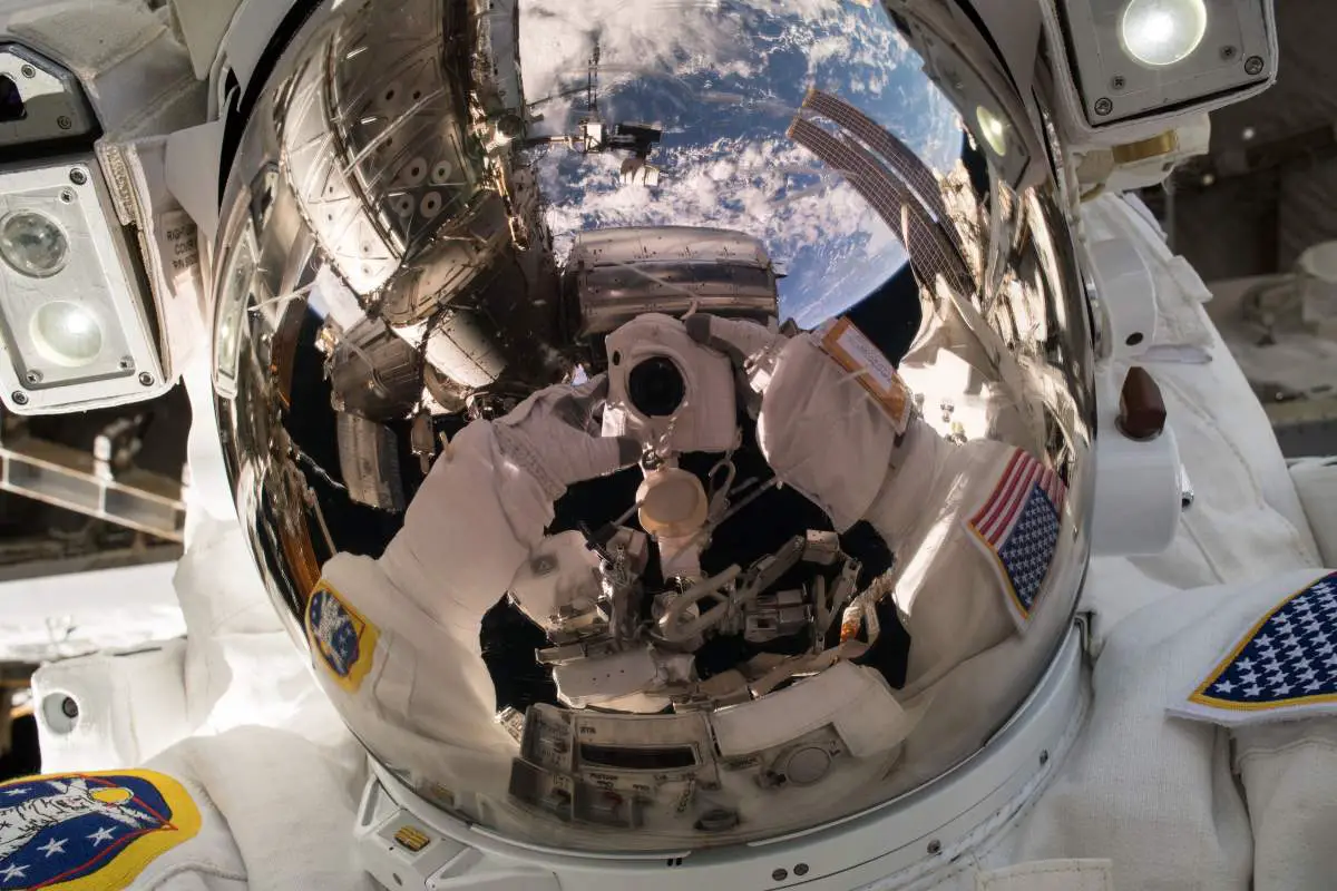
NASA Astronaut Ricky Arnold published an amazing “selfie” from space on his Twitter account saying “An amazing view of our one and only planet”. He took this selfie during the May 16, 2018 spacewalk to perform upgrades on the International Space Station. We can see the Earth, the beautiful blue marble, reflecting on his helmet’s visor.

During the spacewalk which lasted for 6 hours and 31 minutes, Arnold and fellow NASA astronaut Andrew J. Feustel transferred a Pump Flow Control Subassembly over to Dextre stowed failed PFCS on ESP-1, replaced camera and lights used to film NASA TV, replaced Space to Ground Transceiver Controller, performed “get aheads” to Install handrails on Radiator Grapple Bars on S1, removed thermal blankets and MLI from two Direct Current Switching Units on ESP-2, and prepped the Flex Hose Rotary Coupler on S1 for replacement.

Spacewalk suffered a 7-minute delay because of a water leak that formed ice crystals inside the airlock. The spacewalk brought Arnold’s cumulative EVA (Extravehicular activity) time to over 18 hours.

Categories
Earth from Space Moon Landing Space Exploration

Earth as seen by Apollo 4

A crescent-Earth photo, by an automatic camera aboard the unpiloted Apollo 4 command module on November 9, 1967, at an altitude of 11,200 miles (18,000 km). Apollo 4, (also known as AS-501), was the first uncrewed test flight of NASA’s mighty Saturn V rocket, which was used by the U.S. Apollo program to send the first astronauts to the Moon.

Categories
Earth from Space Space Exploration

Buzz Aldrin’s “Selfie” during Gemini XII Mission

On November 12, 1966, during the Gemini 12 mission EVA 1 (Extravehicular activity), NASA astronaut Edwin “Buzz” Aldrin took his own self-portrait with his camera with our beautiful Earth in the background. This historic photo is widely regarded as the “first space selfie”.

Categories
Earth from Space Places Space Exploration

Mont Saint-Michel, France, From Space

The European Space Agency (ESA) occasionally posts high-resolution photos of space under the title of “week in images”. This amazing image of the Mont Saint-Michel from space, which was captured on 21 June 2017, is also featured on the ESA’s Earth from Space video programme, presented by Kelsea Brennan-Wessels from the ESA Web-TV virtual studios.

Categories
Space Exploration Earth from Space History People

Astronaut Honors Holocaust Remembrance Day from space with “Moon Landscape” drawing by Holocaust victim Petr Ginz

NASA Astronaut Andrew Jay “Drew” Feustel, who is currently living and working aboard the International Space Station, published a photo on his Twitter account with a replica of the “Moon Landscape” drawing by Holocaust victim Petr Ginz to honor Holocaust Remembrance Day (Yom HaShoah). The replica of the painting was first flown in space by Ilan Ramon (June 20, 1954 – February 1, 2003), the first Israeli astronaut for NASA. Ramon has died in the re-entry accident of STS-107, the fatal mission of the Space Shuttle Columbia. Ilan Ramon’s mother and grandmother were Auschwitz survivors, and his grandfather and other family members perished in Nazi death camps.

Feustel took with him to space a copy of a special drawing entitled “Moon Landscape”, which was created by a Jewish Czech boy named Petr Ginz (1 February 1928 – 28 September 1944) while incarcerated in Terezin, Czechoslovakia, during World War II. The drawing depicts how Earth would look from the surface of the moon. Petr was fascinated by science fiction and inspired by his favorite author, the French novelist, poet, and playwright Jules Verne (8 February 1828 – 24 March 1905), to draw and write stories about a far-off world he would never visit. At the age of 16, Petr lost his life at Auschwitz.

Categories
Earth from Space Geology Space Exploration

Kliuchevskoi Volcano from Space (NASA Image)

During the STS-68 mission (September 30-October 11, 1994), the crew members of Space Shuttle Endeavour used a 70 mm camera to photograph Klyuchevskaya Sopka (also known as Kliuchevskoi), a stratovolcano, the highest mountain on the Kamchatka Peninsula of Russia and the highest active volcano of Eurasia. The eruption was new when this photo was taken. It was photographed from 115 nautical miles (213 kilometers) above Earth.